Cof Cymru: National Historic Assets of Wales · Wales
Goetre Farmhouse, with attached farm building
Llannor, Gwynedd, Wales
A Grade II listed building in Efailnewydd, Pwllheli, Llannor, Gwynedd, designated on 8 February 1999.
The record
- Designation
- Listed building, Grade II
- Broad class
- Domestic
- Date of designation
- 8 February 1999
- Locality
- Efailnewydd
- Town
- Pwllheli
- Community
- Llannor
- Unitary authority
- Gwynedd
- Country
- Wales
- Coordinates
- 52.89422, -4.44271
- Cadw reference
- 21331
Slide toward Today to fade the historical sheet and see the modern map underneath.
David Rumsey Map Collection, Stanford LibrariesDavid Rumsey Map Collection, Stanford LibrariesDavid Rumsey Map Collection, Stanford LibrariesDavid Rumsey Map Collection, Stanford LibrariesDavid Rumsey Map Collection, Stanford Libraries
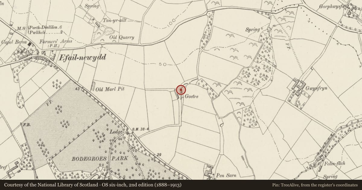
5 historical maps cover this location, the earliest the 1830 map "V.3:11-15:XV. Britisches Reich. A. Kon: England. b. Frstenthum Wales: Shire: 37-40" (David Rumsey Map Collection, Stanford Libraries).
Historical maps covering this location
- 1830 · V.3:11-15:XV. Britisches Reich. A. Kon: England. b. Frstenthum Wales: Shire: 37-40 (David Rumsey Map Collection, Stanford Libraries)
- 1883 · Watershed map England, Wales 3. (David Rumsey Map Collection, Stanford Libraries)
- 1896 · Sheet 7. Ordnance Survey of England and Wales. (David Rumsey Map Collection, Stanford Libraries)
- 1899 · 134 Pwllheli (Hills) (David Rumsey Map Collection, Stanford Libraries)
- 1901 · Sheet 9 and 10. (David Rumsey Map Collection, Stanford Libraries)
Cadw's description
Location
The farm lies back from the main road running NW from Pwllheli, almost opposite Bodegroes Lodge.
History
Farmhouse of C17 origin, probably built by the Revd John Owens, Chancellor of the Diocese of Bangor and vicar of Llannor as his own residence. It was raised to 2 storeys in the C18.
Exterior
Built of local stone rubble with an old irregular-sized slate roof and off-centre stack. The original house is probably the 3 window range nearest the farm building, and extended, probably in the C19 beyond the gable stack by a further 2 window bays with a large brick stack. The main entrance is a modern part-glazed door central to the original section, flanked by 4-pane sashes; 9-paned sashes above, the central window offset to left. Left hand section has doorway with 12-pane sash window to left, and 2x9-pane sashes above. Modern windows at the rear.
The farm building is attached in line. Three bays, perhaps built as a lofted cowhouse with granary above. Two boarded doors with a ventilation slit between them and a small window to the right. Two trusses with lapped collars supporting 2 tiers of purlins, the soffit of the slate battens torched. An incised figure 38 upside down on the collar.
Interior
The main living room has a heavy chamfered cross beam, supporting on one side a spine beam. No other notable historic features.
Reason for designation
Included as a traditional range of house and farm building retaining in its long plan and constructional detail, elements of the early character, and with later detail still within the vernacular tradition.
Nearby in the register
- Plas BodegroesDomesticunder 1 mi
- Pont Pensarn (partly in Pwllheli Community)Transportunder 1 mi
- Pont PensarnTransportunder 1 mi
- Ffynnon Felin BachCommemorativeunder 1 mi
Other entries of the same register within about three miles of this one, by straight line.