Cof Cymru: National Historic Assets of Wales · Wales
Church Hall
Llannor, Gwynedd, Wales
A Grade II listed building in Abererch, Pwllheli, Llannor, Gwynedd, designated on 8 February 1999.
The record
- Designation
- Listed building, Grade II
- Broad class
- Religious, Ritual and Funerary
- Date of designation
- 8 February 1999
- Locality
- Abererch
- Town
- Pwllheli
- Community
- Llannor
- Unitary authority
- Gwynedd
- Country
- Wales
- Coordinates
- 52.90289, -4.38604
- Cadw reference
- 21325
Slide toward Today to fade the historical sheet and see the modern map underneath.
David Rumsey Map Collection, Stanford LibrariesDavid Rumsey Map Collection, Stanford LibrariesDavid Rumsey Map Collection, Stanford LibrariesDavid Rumsey Map Collection, Stanford LibrariesLlyfrgell Genedlaethol Cymru – The National Library of Wales
5 historical maps cover this location, the earliest the 1795 map "To Sir Watkin Williams-Wynn Bart ... the map of the six counties of North Wales is most humbly inscribed by his obedient humble servant" (Llyfrgell Genedlaethol Cymru – The National Library of Wales).
Historical maps covering this location
- 1795 · To Sir Watkin Williams-Wynn Bart ... the map of the six counties of North Wales is most… (Llyfrgell Genedlaethol Cymru – The National Library of Wales)
- 1883 · Watershed map England, Wales 3. (David Rumsey Map Collection, Stanford Libraries)
- 1896 · Sheet 7. Ordnance Survey of England and Wales. (David Rumsey Map Collection, Stanford Libraries)
- 1899 · 134 Pwllheli (Hills) (David Rumsey Map Collection, Stanford Libraries)
- 1901 · Sheet 9 and 10. (David Rumsey Map Collection, Stanford Libraries)
Cadw's description
Location
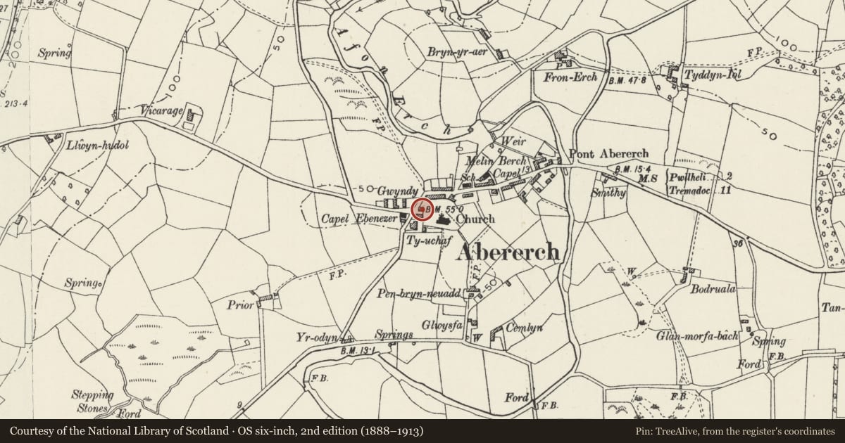
The church hall stands in a walled enclosure at the side of the main access to the churchyard, opposite Ty-uchaf.
History
Probably built in the early-mid C19 as a parson's gig house, later adapted as a parish room.
Exterior
Built of rubble stonework with a roof covered with small slates, coping stones at the W end. An original wide cart entrance with a stone lintel has been infilled by a pair of framed and boarded doors with an overlight, and modern metal windows in subframes. A lean-to churchyard store has been added to the rear. The slate paved forecourt is walled against the road and accessway to the church with a stone wall.
Interior
The interior has been ceiled and modernised.
Reason for designation
Included largely for group value with Ty-uchaf and the Church of St Cawdraf, but retaining some vernacular character and sufficient detail to indicate its original use.
Nearby in the register
- Ty-uchafDomesticunder 1 mi
- Picton Jones MonumentReligious, Ritual and Funeraryunder 1 mi
- Capel EbenezerReligious, Ritual and Funeraryunder 1 mi
- Ebenezer Cottage (Ty-capel)Domesticunder 1 mi
Other entries of the same register within about three miles of this one, by straight line.