Cof Cymru: National Historic Assets of Wales · Wales
Usk Bridge (partly in Llanbadoc Community)
Usk, Monmouthshire, Wales
A Grade II* listed building in Usk, Monmouthshire, designated on 1 April 1974.
The record
- Designation
- Listed building, Grade II*
- Broad class
- Transport
- Date of designation
- 1 April 1974
- Welsh name
- Pont Brynbuga (yn rhannol yng nghymuned Llanbadog)
- Town
- Usk
- Community
- Usk
- Unitary authority
- Monmouthshire
- Country
- Wales
- Coordinates
- 51.70184, -2.90682
- Cadw reference
- 2129
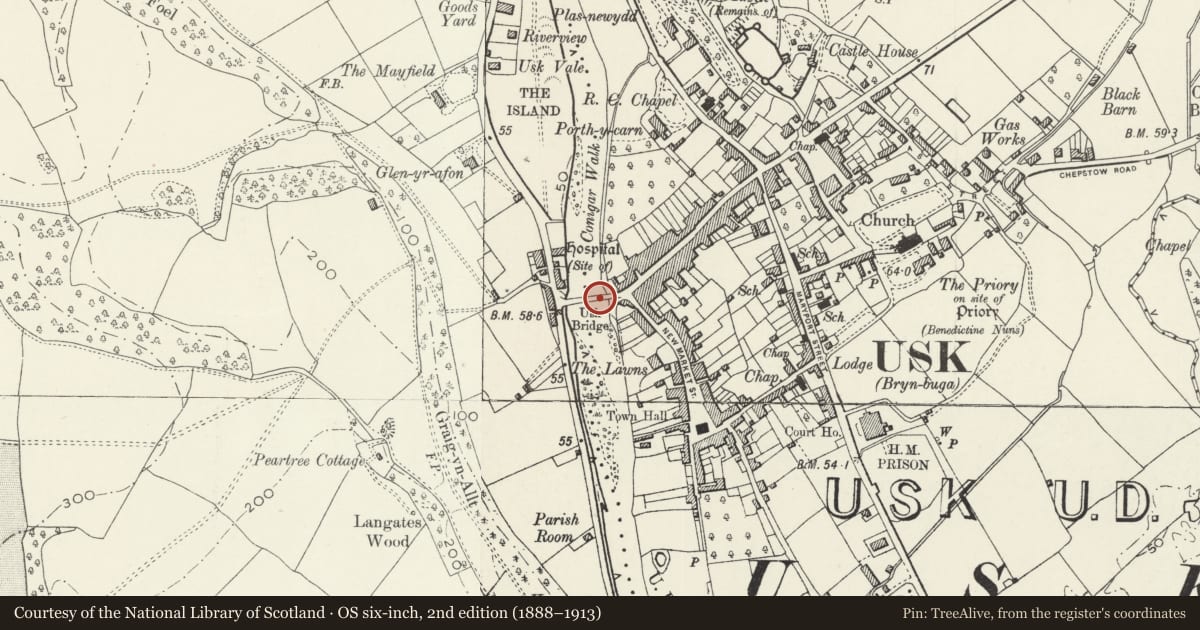
Slide toward Today to fade the historical sheet and see the modern map underneath.
David Rumsey Map Collection, Stanford LibrariesDavid Rumsey Map Collection, Stanford LibrariesDavid Rumsey Map Collection, Stanford LibrariesDavid Rumsey Map Collection, Stanford LibrariesDavid Rumsey Map Collection, Stanford Libraries
5 historical maps cover this location, the earliest the 1636 map "Cornubia : Devonia, Somersetus, Dorcestria, Wiltonia, Glocestria ..." (David Rumsey Map Collection, Stanford Libraries).
Historical maps covering this location
- 1636 · Cornubia : Devonia, Somersetus, Dorcestria, Wiltonia, Glocestria ... (David Rumsey Map Collection, Stanford Libraries)
- 1637 · The fourth table of England. Cornub. Devonia, Somerset etc. (David Rumsey Map Collection, Stanford Libraries)
- 1830 · V.3:11-15:XV.Britisches Reich. A. Kon: England. a. England ab sich: Shire:15-17, 33 (David Rumsey Map Collection, Stanford Libraries)
- 1895 · Sheet 11. Ordnance Survey of England and Wales. (David Rumsey Map Collection, Stanford Libraries)
- 1913 · Sheet 102. Newport. (David Rumsey Map Collection, Stanford Libraries)
Cadw's description
Location
On the east side of R Usk; carries the A472 across the river.
History
The bridge was first built in 1746-47, possibly (according to Malkin's guide book of 1804) to the design of William Edwards, the great bridge builder of South Wales; and was widened on both sides in 1836-37, but maintaining the same appearance. It has been little altered since.
Exterior
The bridge is built of local red sandstone which is coursed and squared but is well short of being ashlar, including the arch dressings and the parapet coping. There are five segmental arches with the road ramped up to the centre. Pointed cutwaters fading into pilasters between each arch and on both faces of the bridge. The widening of the bridge on both sides can clearly be seen in the arch soffits. There is a continuous band above the arches but this is hidden on the down-stream side by an attached cast iron pipe. Parapet wall with flat stone coping.
Reason for designation
Graded II* as well-proportioned and handsome bridge from the turnpike era which was possibly designed by William Edwards.
Nearby in the register
- Usk Bridge (partly in Usk Community)Transportunder 1 mi
- The Cardiff Arms PH and attached wingCommercialunder 1 mi
- 67 Bridge StreetCommercialunder 1 mi
- The Old TollhouseTransportunder 1 mi
Other entries of the same register within about three miles of this one, by straight line.