Cof Cymru: National Historic Assets of Wales · Wales
Crumlin Old Bridge over River Ebbw
Crumlin, Caerphilly, Wales
A Grade II listed building in Crumlin, Caerphilly, designated on 29 January 1999.
The record
- Designation
- Listed building, Grade II
- Broad class
- Transport
- Date of designation
- 29 January 1999
- Locality
- Crumlin
- Community
- Crumlin
- Unitary authority
- Caerphilly
- Country
- Wales
- Coordinates
- 51.67922, -3.13917
- Cadw reference
- 21257
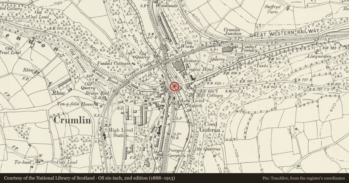
Slide toward Today to fade the historical sheet and see the modern map underneath.
David Rumsey Map Collection, Stanford LibrariesDavid Rumsey Map Collection, Stanford LibrariesDavid Rumsey Map Collection, Stanford LibrariesDavid Rumsey Map Collection, Stanford LibrariesDavid Rumsey Map Collection, Stanford Libraries
5 historical maps cover this location, the earliest the 1636 map "Cornubia : Devonia, Somersetus, Dorcestria, Wiltonia, Glocestria ..." (David Rumsey Map Collection, Stanford Libraries).
Historical maps covering this location
- 1636 · Cornubia : Devonia, Somersetus, Dorcestria, Wiltonia, Glocestria ... (David Rumsey Map Collection, Stanford Libraries)
- 1637 · The fourth table of England. Cornub. Devonia, Somerset etc. (David Rumsey Map Collection, Stanford Libraries)
- 1895 · Sheet 11. Ordnance Survey of England and Wales. (David Rumsey Map Collection, Stanford Libraries)
- 1906 · 249 Newport (Hills) (David Rumsey Map Collection, Stanford Libraries)
- 1913 · Sheet 102. Newport. (David Rumsey Map Collection, Stanford Libraries)
Cadw's description
Location
Just S of and joined to the now pedestrianised former main road bridge over the river.
History
Probably C18 and probably as shown on Tithe Map 1846. The later road bridge over the Ebbw to which it is attached continues over the adjacent railway line, the Western Valley Line constructed c 1850. Stone inscribed 'Mynyddislwyn Highway District MR 188?' is a later insertion; such stones are found elsewhere in the area.
Exterior
A single span humpbacked bridge of stone rubble with splayed approaches. Formerly with flat stone copings only two of which remain, the rest repaired in brick and concrete. Parapet substantially rebuilt in places, using rockfaced stone in place of the original narrower courses of rubble. Deep uneven narrow stone voussoirs. Parapet is very low and the river arch quite wide, thus viewed from the side the structure appears light and graceful.
Reason for designation
Listed as a rare survival in this area of a river bridge pre-dating the main industrial development.
Nearby in the register
- Crumlin Viaduct NE Abutment Cwm KendonTransportunder 1 mi
- Crumlin Viaduct W Abutment Ebbw ValleyTransportunder 1 mi
- Crumlin Viaduct E Abutment Ebbw ValleyTransportunder 1 mi
- Viaduct CottageDomesticunder 1 mi
Other entries of the same register within about three miles of this one, by straight line.