Cof Cymru: National Historic Assets of Wales · Wales
The Cottage
Merthyr Mawr, Bridgend, Wales
A Grade II listed building in Merthyr Mawr, Bridgend, designated on 26 July 1963.
The record
- Designation
- Listed building, Grade II
- Broad class
- Domestic
- Date of designation
- 26 July 1963
- Locality
- Merthyr Mawr
- Community
- Merthyr Mawr
- Unitary authority
- Bridgend
- Country
- Wales
- Coordinates
- 51.48563, -3.60821
- Cadw reference
- 21238
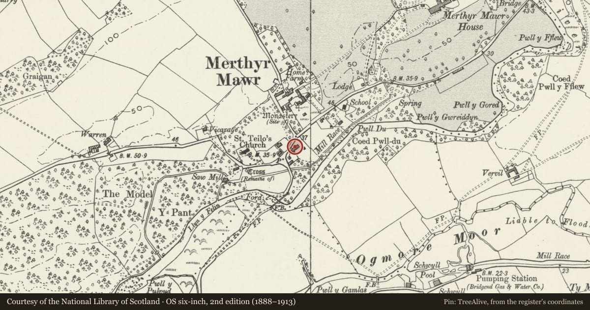
Slide toward Today to fade the historical sheet and see the modern map underneath.
David Rumsey Map Collection, Stanford LibrariesDavid Rumsey Map Collection, Stanford LibrariesDavid Rumsey Map Collection, Stanford LibrariesDavid Rumsey Map Collection, Stanford LibrariesDavid Rumsey Map Collection, Stanford Libraries
5 historical maps cover this location, the earliest the 1636 map "Cornubia : Devonia, Somersetus, Dorcestria, Wiltonia, Glocestria ..." (David Rumsey Map Collection, Stanford Libraries).
Historical maps covering this location
- 1636 · Cornubia : Devonia, Somersetus, Dorcestria, Wiltonia, Glocestria ... (David Rumsey Map Collection, Stanford Libraries)
- 1637 · The fourth table of England. Cornub. Devonia, Somerset etc. (David Rumsey Map Collection, Stanford Libraries)
- 1865 · England and Wales. England No. 6. (David Rumsey Map Collection, Stanford Libraries)
- 1897 · 262 Pontypridd (Hills) (David Rumsey Map Collection, Stanford Libraries)
- 1897 · 262 Pontypridd (Outline) (David Rumsey Map Collection, Stanford Libraries)
Cadw's description
Location
Approximately 100m E of parish church and set back from the main road through the village. The house is at the uphill end of a group with Oak Cottage.
Interior
Modernised internally.
Reason for designation
Oak Cottage and The Cottage form a pair of C19 estate cottages with interesting earlier origins, and for group value with other estate buildings in Merthyr Mawr.
Nearby in the register
- Oak CottageDomesticunder 1 mi
- Diana CottageDomesticunder 1 mi
- Church CottageDomesticunder 1 mi
- WellingtoniaDomesticunder 1 mi
Other entries of the same register within about three miles of this one, by straight line.