Cof Cymru: National Historic Assets of Wales · Wales
Diana Cottage
Merthyr Mawr, Bridgend, Wales
A Grade II listed building in Merthyr Mawr, Bridgend, designated on 26 July 1963.
The record
- Designation
- Listed building, Grade II
- Broad class
- Domestic
- Date of designation
- 26 July 1963
- Locality
- Merthyr Mawr
- Community
- Merthyr Mawr
- Unitary authority
- Bridgend
- Country
- Wales
- Coordinates
- 51.48538, -3.60844
- Cadw reference
- 11240
Slide toward Today to fade the historical sheet and see the modern map underneath.
David Rumsey Map Collection, Stanford LibrariesDavid Rumsey Map Collection, Stanford LibrariesDavid Rumsey Map Collection, Stanford LibrariesDavid Rumsey Map Collection, Stanford LibrariesDavid Rumsey Map Collection, Stanford Libraries
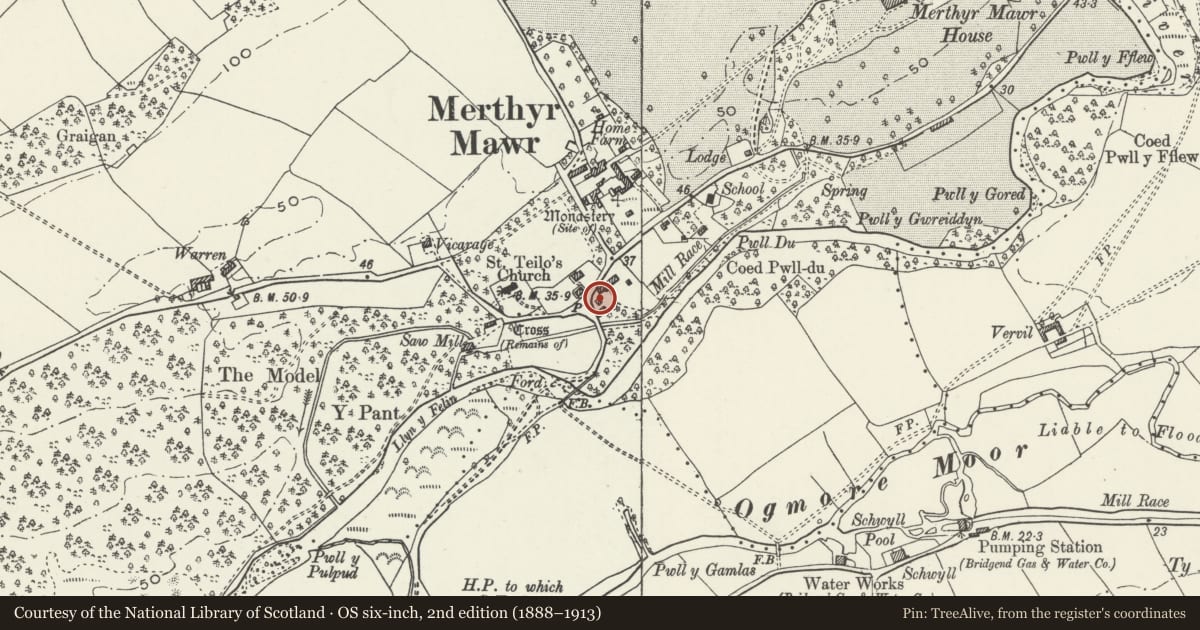
5 historical maps cover this location, the earliest the 1636 map "Cornubia : Devonia, Somersetus, Dorcestria, Wiltonia, Glocestria ..." (David Rumsey Map Collection, Stanford Libraries).
Historical maps covering this location
- 1636 · Cornubia : Devonia, Somersetus, Dorcestria, Wiltonia, Glocestria ... (David Rumsey Map Collection, Stanford Libraries)
- 1637 · The fourth table of England. Cornub. Devonia, Somerset etc. (David Rumsey Map Collection, Stanford Libraries)
- 1865 · England and Wales. England No. 6. (David Rumsey Map Collection, Stanford Libraries)
- 1897 · 262 Pontypridd (Hills) (David Rumsey Map Collection, Stanford Libraries)
- 1897 · 262 Pontypridd (Outline) (David Rumsey Map Collection, Stanford Libraries)
Cadw's description
Location
Approximately 100m ESE of the parish church and on the E side of a junction with a minor road to a footbridge over the Ogmore river.
History
Small single-unit end-entry house built c1700 and not subsequently enlarged, except for a small projection at the rear.
Exterior
One-and-a-half storey cube-shaped cottage of whitewashed rubble stone and thatch roof. In the gable end is a large stepped external stack, to the R of which is a half-lit door renewed in the original doorway. The R side wall has an enlarged 3-light casement. The rear gable end has a low single-storey projection offset to R, also with thatch roof, a small window lower L and an attic casement.
Interior
The original fireplace has a stop-chamfered surround, with a segmental-chamfered lintel.
Reason for designation
A rare example of an unimproved cottage of c1700, retaining original form and detail. Also for group value with other listed items in Merthyr Mawr and on the Merthyr Mawr Estate.
Nearby in the register
- Oak CottageDomesticunder 1 mi
- The CottageDomesticunder 1 mi
- Church CottageDomesticunder 1 mi
- WellingtoniaDomesticunder 1 mi
Other entries of the same register within about three miles of this one, by straight line.