Cof Cymru: National Historic Assets of Wales · Wales
Ashford Cottage
Talybont-on-Usk, Powys, Wales
A Grade II listed building in Llanddetti, Talybont-on-Usk, Powys, designated on 17 December 1998.
The record
- Designation
- Listed building, Grade II
- Broad class
- Domestic
- Date of designation
- 17 December 1998
- Locality
- Llanddetti
- Community
- Talybont-on-Usk
- Unitary authority
- Powys
- Country
- Wales
- Coordinates
- 51.88390, -3.27675
- Cadw reference
- 21215
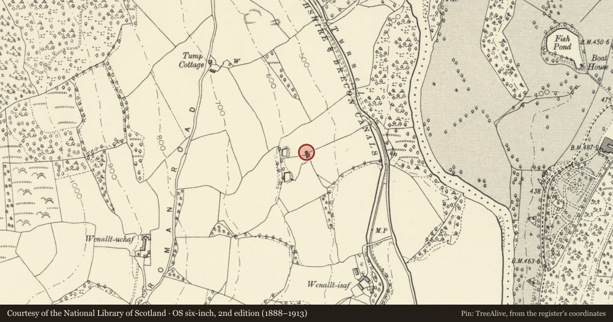
Slide toward Today to fade the historical sheet and see the modern map underneath.
David Rumsey Map Collection, Stanford LibrariesDavid Rumsey Map Collection, Stanford LibrariesDavid Rumsey Map Collection, Stanford LibrariesDavid Rumsey Map Collection, Stanford LibrariesDavid Rumsey Map Collection, Stanford Libraries
5 historical maps cover this location, the earliest the 1608 map "(13) Cambriae Typus." (David Rumsey Map Collection, Stanford Libraries).
Historical maps covering this location
- 1608 · (13) Cambriae Typus. (David Rumsey Map Collection, Stanford Libraries)
- 1636 · Cornubia : Devonia, Somersetus, Dorcestria, Wiltonia, Glocestria ... (David Rumsey Map Collection, Stanford Libraries)
- 1856 · 42. Brecon. (David Rumsey Map Collection, Stanford Libraries)
- 1896 · 214 Talgarth (Hills) (David Rumsey Map Collection, Stanford Libraries)
- 1901 · Sheet 14. (David Rumsey Map Collection, Stanford Libraries)
Cadw's description
Location
Set into the hillside above the B4558 overlooking the Monmouthshire and Brecon Canal, Ashford Tunnel and Ashford
History
Probably early C19 and perhaps associated with the Brecknock and Abergavenny Canal which was begun in 1797.
Exterior
Small two storey cottage built into the hillside with gable end facing downhill to the canal. Of whitewashed stone rubble with Welsh slate roof. 2 window range of 9 pane Breconshire hoppers to first floor, entrance below; prominent gable end has a single pointed arched window with Gothick tracery to each floor.
Interior
Not inspected at time of survey (11th November 1997).
Reason for designation
Included as a prominent rural dwelling retaining historic character and possibly associated with the canal.
Group value with the nearby Ashford Tunnel S Portal and Ashford.
Nearby in the register
- Ashford Tunnel S Portal (Monmouthshire and Brecon Canal)Transportunder 1 mi
- Wenallt Upper Bridge (Canal Bridge No.141)Transportunder 1 mi
- Ashford tunnel N Portal (Monmouthshire and Brecon Canal)Transportunder 1 mi
- AshfordDomesticunder 1 mi
Other entries of the same register within about three miles of this one, by straight line.