Cof Cymru: National Historic Assets of Wales · Wales
Group of 4 chest tombs within railed enclosure to SW of church of St Meugan
Talybont-on-Usk, Powys, Wales
A Grade II listed building in Llanfeugan, Talybont-on-Usk, Powys, designated on 17 December 1998.
The record
- Designation
- Listed building, Grade II
- Broad class
- Commemorative
- Date of designation
- 17 December 1998
- Locality
- Llanfeugan
- Community
- Talybont-on-Usk
- Unitary authority
- Powys
- Country
- Wales
- Coordinates
- 51.91169, -3.32939
- Cadw reference
- 21196
Slide toward Today to fade the historical sheet and see the modern map underneath.
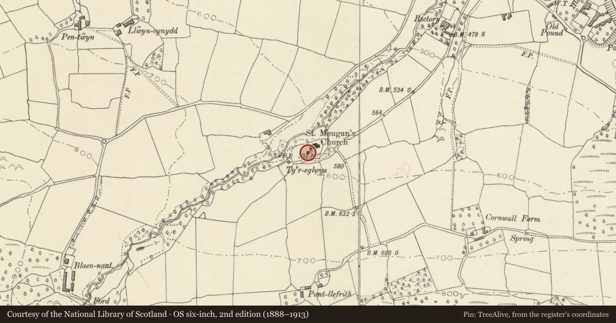
David Rumsey Map Collection, Stanford LibrariesDavid Rumsey Map Collection, Stanford LibrariesNational Library of ScotlandDavid Rumsey Map Collection, Stanford LibrariesDavid Rumsey Map Collection, Stanford Libraries
5 historical maps cover this location, the earliest the 1608 map "(13) Cambriae Typus." (David Rumsey Map Collection, Stanford Libraries).
Historical maps covering this location
- 1608 · (13) Cambriae Typus. (David Rumsey Map Collection, Stanford Libraries)
- 1636 · Cornubia : Devonia, Somersetus, Dorcestria, Wiltonia, Glocestria ... (David Rumsey Map Collection, Stanford Libraries)
- 1853 · Sheet XLII SW Becon - Ordnance Survey of England and Wales, One-inch to the mile, Old… (National Library of Scotland)
- 1856 · 42. Brecon. (David Rumsey Map Collection, Stanford Libraries)
- 1901 · Sheet 14. (David Rumsey Map Collection, Stanford Libraries)
Cadw's description
Location
In the churchyard SW of the church under a group of ancient yew trees.
History
Tombs are close-set and overgrown with ivy with only one inscription legible, to May Williams of Coity Mawr died 1855. Coity Mawr is a major country house remodelled early C19 on the hillside near Cwm Cwy.
Exterior
The 4 close-set chest tombs are very similar, comprising tooled slabs, rusticated tooled stone chests, battered tooled plinths. Spear railings with urned stanchions on a tooled stone plinth form the rectangular enclosure.
Reason for designation
Included as an interesting group of mid C19 family tombs and for group value with the church of St Meugan, the churchyard cross and other listed churchyard monuments.
Nearby in the register
- Group of 3 chest tombs S of church of St MeuganCommemorativeunder 1 mi
- Group of 3 chest tombs W of church of St MeuganCommemorativeunder 1 mi
- Church of St MeuganReligious, Ritual and Funeraryunder 1 mi
- Churchyard cross shaft to S of Church of St MeuganReligious, Ritual and Funeraryunder 1 mi
Other entries of the same register within about three miles of this one, by straight line.