Cof Cymru: National Historic Assets of Wales · Wales
Church of St Meugan
Talybont-on-Usk, Powys, Wales
A Grade II* listed building in Llanfeugan, Talybont-on-Usk, Powys, designated on 17 January 1963.
The record
- Designation
- Listed building, Grade II*
- Broad class
- Religious, Ritual and Funerary
- Date of designation
- 17 January 1963
- Locality
- Llanfeugan
- Community
- Talybont-on-Usk
- Unitary authority
- Powys
- Country
- Wales
- Coordinates
- 51.91185, -3.32911
- Cadw reference
- 21105
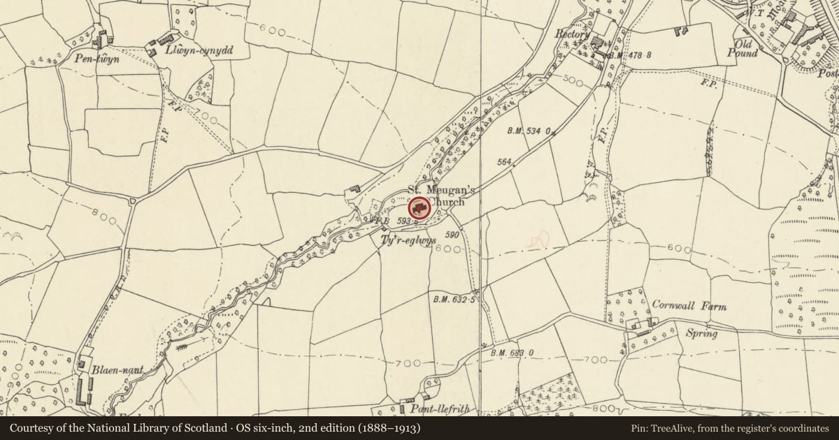
Slide toward Today to fade the historical sheet and see the modern map underneath.
David Rumsey Map Collection, Stanford LibrariesDavid Rumsey Map Collection, Stanford LibrariesNational Library of ScotlandDavid Rumsey Map Collection, Stanford LibrariesDavid Rumsey Map Collection, Stanford Libraries
5 historical maps cover this location, the earliest the 1608 map "(13) Cambriae Typus." (David Rumsey Map Collection, Stanford Libraries).
Historical maps covering this location
- 1608 · (13) Cambriae Typus. (David Rumsey Map Collection, Stanford Libraries)
- 1636 · Cornubia : Devonia, Somersetus, Dorcestria, Wiltonia, Glocestria ... (David Rumsey Map Collection, Stanford Libraries)
- 1853 · Sheet XLII SW Becon - Ordnance Survey of England and Wales, One-inch to the mile, Old… (National Library of Scotland)
- 1856 · 42. Brecon. (David Rumsey Map Collection, Stanford Libraries)
- 1901 · Sheet 14. (David Rumsey Map Collection, Stanford Libraries)
Cadw's description
Location
At Llanfeugan, in an isolated position SW of the hamlet of Pencelli, on the W bank of a deep-cutting stream, surrounded by an elliptical churchyard with stone stile entrance.
History
Probably an Early Christian site. Ralph de Mortimer of Pencelli castle built a church here c1272. Probably a C14 N aisle was added to the C13 nave which itself was then rebuilt in the late Middle Ages. Restoration by S W Williams, architect of Rhayader, in 1891. The History of Brecknockshire records a number of discoveries made during restoration: N aisle raised by imported sand, described as the oldest part of the church; evidence of former lower nave roof; C13 church had west wall demolished when tower built; chancel extended late C15 when N aisle rebuilt; roodloft in position in 1813 and gallery formerly extended across nave; wallpaintings depicting the White Rose of York found on wall by tower.
Exterior
Of stone rubble with clay tile roof. Plan of large W tower, continuous nave and chancel, S porch, N aisle. Broad embattled W tower of 3 storeys surmounted by a weathercock, stair turret NE, water chutes at corners with heavy lead-covered string course above; louvred pointed arched openings with paired trefoil headed lights to ringing chamber with string course below forming a hood over small rectangular lights to tower chambers; similar to ground floor with double battered plinth below. Plain S porch has segmental pointed arched doorway with rough voussoirs. Nave and chancel without division though a building line shows mid-way along the S wall; to W of porch a 2 light window with cusped tracery in a moulded pointed arched surround; other S windows comprise cusped lights in a rectangular surround, 2 to nave and 2 to chancel; chamfered Tudor-arched priests' doorway. E window has 3 narrow lancets in a pointed arched surround and NE window 2 cusped lancets in a rectangular surround. N aisle is battered; blocked chamfered pointed arched N doorway; 2 light trefoil-headed window; paired lancets. Windows have heavy iron armatures.
Interior
Porch has 2 stone and wood seats, a boarded roof of 2 bays with a collar and tie truss and a chamfered and stopped cross beam. S pointed arched door is also chamfered and stopped and has double doors with 2 pairs of decorative hinges. Interior has had plaster removed. Late medieval wagon roof, boarded behind, has reeded ribs. Four bay N arcade has 2 broached octagonal piers, unusual stepped capitals and chamfered arches; E respond has similar capital and continuous chamfers, rubble pier to W shows where C13 N wall was extended into C14 N aisle. W tower arch is simple and pointed with a later wide screened opening to tower chamber above. Woodwork includes an important central section of a former chancel screen now sited against N aisle wall, with slender canopywork buttresses and moulded headbeam, traces of paintwork. Uncommon chancel stalls dated (by Haslam) c1700 have panelled backs, narrow seats, and simple but stoutly carved ends. Pulpit may also incorporate C17 work. Monuments include cartouche to Lewis Gunter (d 1683) incorporating serpents; many early C19 grey and white marble wall monuments; many ledger slabs; octagonal font on a circular base; niche E of S door.
Reason for designation
Listed II* since it retains a high proportion of medieval fabric and some particularly interesting woodwork.
Group value with the churchyard cross and listed churchyard monuments.
Nearby in the register
- Group of 3 chest tombs S of church of St MeuganCommemorativeunder 1 mi
- Churchyard cross shaft to S of Church of St MeuganReligious, Ritual and Funeraryunder 1 mi
- Group of 4 chest tombs within railed enclosure to SW of church of St MeuganCommemorativeunder 1 mi
- Group of 3 chest tombs W of church of St MeuganCommemorativeunder 1 mi
Other entries of the same register within about three miles of this one, by straight line.