Cof Cymru: National Historic Assets of Wales · Wales
Bridge at Abercynafon
Talybont-on-Usk, Powys, Wales
A Grade II listed building in Glyn Collwn, Talybont-on-Usk, Powys, designated on 17 December 1998.
The record
- Designation
- Listed building, Grade II
- Broad class
- Transport
- Date of designation
- 17 December 1998
- Locality
- Glyn Collwn
- Community
- Talybont-on-Usk
- Unitary authority
- Powys
- Country
- Wales
- Coordinates
- 51.84875, -3.33584
- Cadw reference
- 21195
Slide toward Today to fade the historical sheet and see the modern map underneath.
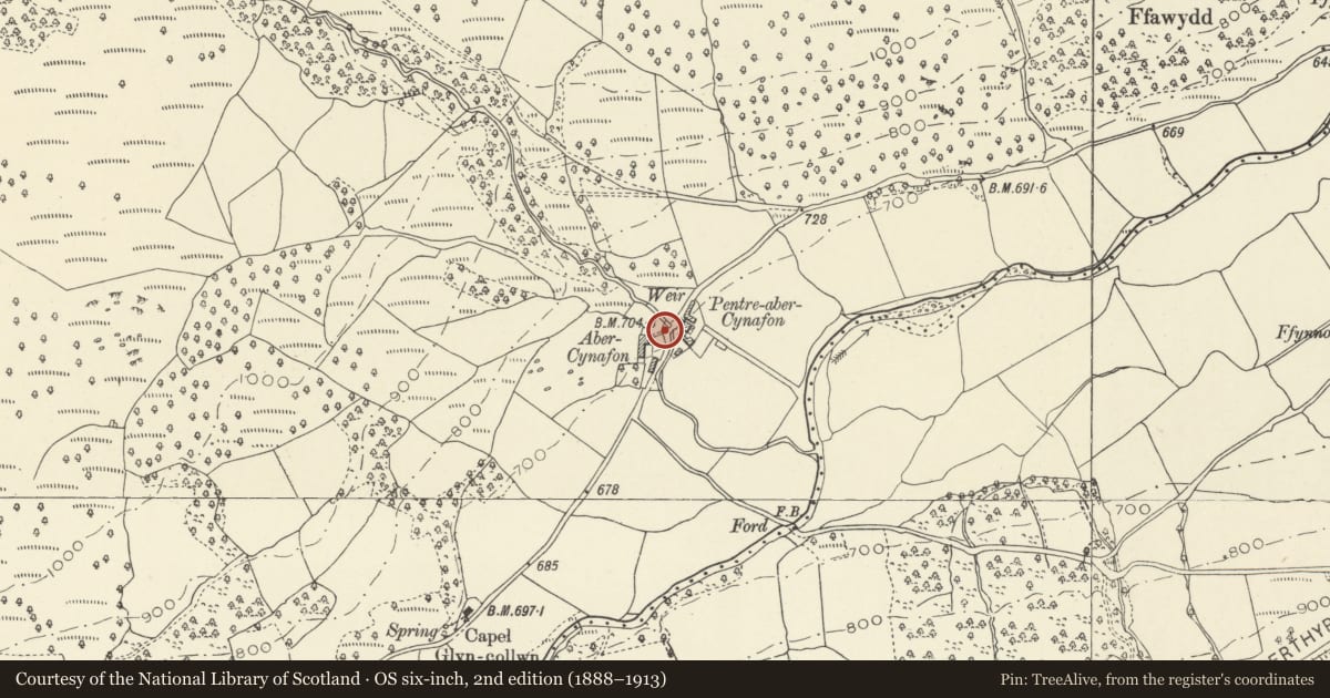
David Rumsey Map Collection, Stanford LibrariesDavid Rumsey Map Collection, Stanford LibrariesNational Library of ScotlandDavid Rumsey Map Collection, Stanford LibrariesDavid Rumsey Map Collection, Stanford Libraries
5 historical maps cover this location, the earliest the 1636 map "Cornubia : Devonia, Somersetus, Dorcestria, Wiltonia, Glocestria ..." (David Rumsey Map Collection, Stanford Libraries).
Historical maps covering this location
- 1636 · Cornubia : Devonia, Somersetus, Dorcestria, Wiltonia, Glocestria ... (David Rumsey Map Collection, Stanford Libraries)
- 1830 · V.3:11-15:XV. Britisches Reich. A. Kon: England. b. Frstenthum Wales: Shire: 37-40 (David Rumsey Map Collection, Stanford Libraries)
- 1856 · 42. Brecon. (David Rumsey Map Collection, Stanford Libraries)
- 1901 · Sheet 14. (David Rumsey Map Collection, Stanford Libraries)
- 1963 · Map No. 11 - Local Government Commission for Wales : [Definitive maps showing proposed… (National Library of Scotland)
Cadw's description
Location
Just N of Abercynafon farm, just off the main valley road, a new bridge over Nant Cynafon having by-passed this older bridge.
History
Early C19, one of a group of bridges of this date on this mountain route, probably related to the opening of the canal at Talybont c 1800 which led to an upgrading of the mountain pass between it and the industrial valleys to south. Tithe map appears to show main route passing to rear of Abercynafon Farm.
Exterior
Segmental arched river bridge of snecked dressed stone with narrow dressed stone voussoirs, curved parapets, replaced saddle back coping, possible illegible or never carved datestone in centre. Curved abutments, approaches and parapets.
Reason for designation
Included as one of a group of early C19 bridges along this mountain route and for group value with the listed items at Abercynafon farm.
Nearby in the register
- Abercynafon farmhouse and attached farm rangeDomesticunder 1 mi
- Barn at AbercynafonAgriculture and Subsistenceunder 1 mi
- Abercynafon Neolithic SiteWaterlogged depositunder 1 mi
- Pen Bwlych Glascwm Pillow MoundsPillow Mound1 mi
Other entries of the same register within about three miles of this one, by straight line.