Cof Cymru: National Historic Assets of Wales · Wales
Terraced steps in Buckland Hall Garden
Talybont-on-Usk, Powys, Wales
A Grade II listed building in Buckland, Talybont-on-Usk, Powys, designated on 17 December 1998.
The record
- Designation
- Listed building, Grade II
- Broad class
- Gardens, Parks and Urban Spaces
- Date of designation
- 17 December 1998
- Locality
- Buckland
- Community
- Talybont-on-Usk
- Unitary authority
- Powys
- Country
- Wales
- Coordinates
- 51.88340, -3.26443
- Cadw reference
- 21189
Slide toward Today to fade the historical sheet and see the modern map underneath.
David Rumsey Map Collection, Stanford LibrariesDavid Rumsey Map Collection, Stanford LibrariesDavid Rumsey Map Collection, Stanford LibrariesDavid Rumsey Map Collection, Stanford LibrariesDavid Rumsey Map Collection, Stanford Libraries
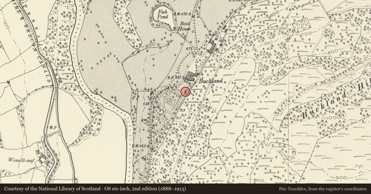
5 historical maps cover this location, the earliest the 1636 map "Cornubia : Devonia, Somersetus, Dorcestria, Wiltonia, Glocestria ..." (David Rumsey Map Collection, Stanford Libraries).
Historical maps covering this location
- 1636 · Cornubia : Devonia, Somersetus, Dorcestria, Wiltonia, Glocestria ... (David Rumsey Map Collection, Stanford Libraries)
- 1856 · 42. Brecon. (David Rumsey Map Collection, Stanford Libraries)
- 1895 · Sheet 11. Ordnance Survey of England and Wales. (David Rumsey Map Collection, Stanford Libraries)
- 1896 · 214 Talgarth (Hills) (David Rumsey Map Collection, Stanford Libraries)
- 1901 · Sheet 14. (David Rumsey Map Collection, Stanford Libraries)
Cadw's description
Location
The terraced garden runs to SW of Buckland House, these steps being towards the end nearest the house.
History
Dated by the Gardens Register as c 1910. They lead to a set of walks in the lower woodland above the house. Buckland Hall was rebuilt in 1898 and owned by the Gwynne Holford family from the mid C19 until 1935.
Exterior
An Italianate flight of stone steps, the lower section a series of 7 wide shallow steps with low bordering parapet walls which have wide shallow saddleback coping. The flight bifurcates and 7 steps ascend on either side of a curved central wall with a semicircular trough at base, ending in low piers with shallow capstones; 7 steps return and a flight of 11 steps ascends to a gateway with piers of tooled stone blocks, at the entrance to the terraced woodland walks. The stone is laid in narrow courses; stone flags to the landings.
Reason for designation
Included as a particularly decorative early C20 garden feature and for group value with other listed items within the grounds at Buckland.
Nearby in the register
- Buckland Hall (aka Buckland House, Buckland and Crosfield House)Domesticunder 1 mi
- Coachhouse and attached stable ranges at Buckland HallDomesticunder 1 mi
- Ice house at Buckland HallDomesticunder 1 mi
- Stables and attached courtyard wall at Buckland HallDomesticunder 1 mi
Other entries of the same register within about three miles of this one, by straight line.