Cof Cymru: National Historic Assets of Wales · Wales
The Royal Oak
Talybont-on-Usk, Powys, Wales
A Grade II listed building in Pencelli, Talybont-on-Usk, Powys, designated on 17 December 1998.
The record
- Designation
- Listed building, Grade II
- Broad class
- Commercial
- Date of designation
- 17 December 1998
- Locality
- Pencelli
- Community
- Talybont-on-Usk
- Unitary authority
- Powys
- Country
- Wales
- Coordinates
- 51.91610, -3.31983
- Cadw reference
- 21134
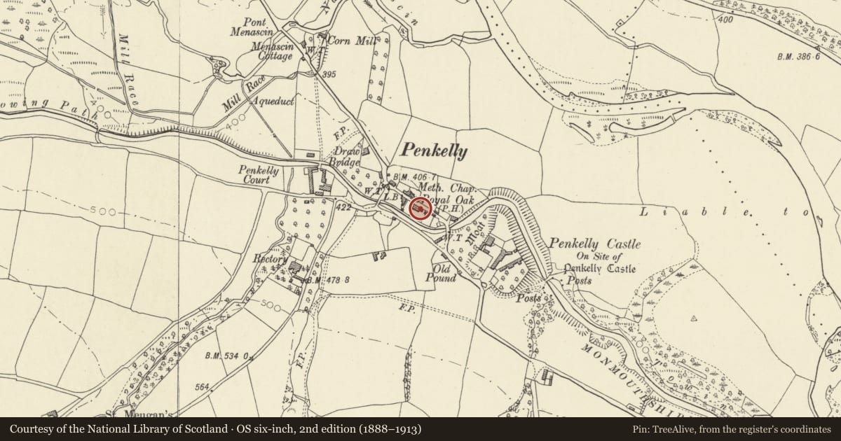
Slide toward Today to fade the historical sheet and see the modern map underneath.
David Rumsey Map Collection, Stanford LibrariesDavid Rumsey Map Collection, Stanford LibrariesDavid Rumsey Map Collection, Stanford LibrariesDavid Rumsey Map Collection, Stanford LibrariesDavid Rumsey Map Collection, Stanford Libraries
5 historical maps cover this location, the earliest the 1608 map "(13) Cambriae Typus." (David Rumsey Map Collection, Stanford Libraries).
Historical maps covering this location
- 1608 · (13) Cambriae Typus. (David Rumsey Map Collection, Stanford Libraries)
- 1636 · Cornubia : Devonia, Somersetus, Dorcestria, Wiltonia, Glocestria ... (David Rumsey Map Collection, Stanford Libraries)
- 1856 · 42. Brecon. (David Rumsey Map Collection, Stanford Libraries)
- 1896 · 214 Talgarth (Hills) (David Rumsey Map Collection, Stanford Libraries)
- 1901 · Sheet 14. (David Rumsey Map Collection, Stanford Libraries)
Cadw's description
Location
In the centre of Pencelli Village backing onto the canal.
History
Probably C18. Monmouthshire and Brecon canal and Pencelli basin close to rear. Some C20 remodelling including an Arts and Crafts style porch.
Exterior
Village inn. Of white painted stone rubble, with part slate part stone tile roof. Main 2 storey building to right has Welsh slate roof, overhanging eaves, ridge stack right and large external stack with offset left; this is partly incoporated into the lower single storey wing left which has a steep pitch stone tile roof. Four window range to main building of 9 pane Breconshire hoppers with timber lintels; shallow later gabled stone porch centre left with Tudor style arch with shallow hoodmould, kneelers of narrow stones and stone tile roof; 2 similar ground floor windows, and an altered window by further doorway end right. Single storey left wing has a 12 pane hopper right and casement left.
Interior
Interior not inspected at time of survey (30th September 1997).
Reason for designation
Listed as an historic village inn retaining much of its character.
Group value with Canal Store and Canal Bridge No.154.
Nearby in the register
- Canal store at PencelliIndustrialunder 1 mi
- Pencelli Bridge (Canal Bridge No.154)Transportunder 1 mi
- Courtyard range immediately SW of Castle FarmhouseDefenceunder 1 mi
- Castle Farm farmhouseDomesticunder 1 mi
Other entries of the same register within about three miles of this one, by straight line.