Cof Cymru: National Historic Assets of Wales · Wales
Granary and Stable Building north of Trellech Farmhouse
Trellech United, Monmouthshire, Wales
A Grade II listed building in Trellech, Monmouth, Trellech United, Monmouthshire, designated on 19 April 1972.
The record
- Designation
- Listed building, Grade II
- Broad class
- Domestic
- Date of designation
- 19 April 1972
- Locality
- Trellech
- Town
- Monmouth
- Community
- Trellech United
- Unitary authority
- Monmouthshire
- Country
- Wales
- Coordinates
- 51.74499, -2.72453
- Cadw reference
- 2112
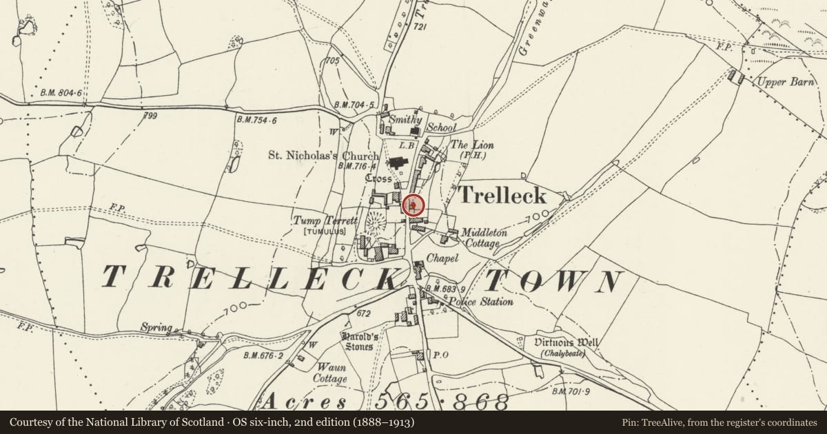
Slide toward Today to fade the historical sheet and see the modern map underneath.
David Rumsey Map Collection, Stanford LibrariesDavid Rumsey Map Collection, Stanford LibrariesDavid Rumsey Map Collection, Stanford LibrariesDavid Rumsey Map Collection, Stanford LibrariesDavid Rumsey Map Collection, Stanford Libraries
5 historical maps cover this location, the earliest the 1636 map "Cornubia : Devonia, Somersetus, Dorcestria, Wiltonia, Glocestria ..." (David Rumsey Map Collection, Stanford Libraries).
Historical maps covering this location
- 1636 · Cornubia : Devonia, Somersetus, Dorcestria, Wiltonia, Glocestria ... (David Rumsey Map Collection, Stanford Libraries)
- 1830 · V.3:11-15:XV.Britisches Reich. A. Kon: England. a. England ab sich: Shire:15-17, 33 (David Rumsey Map Collection, Stanford Libraries)
- 1895 · Sheet 11. Ordnance Survey of England and Wales. (David Rumsey Map Collection, Stanford Libraries)
- 1896 · 233 Monmouth (Hills) (David Rumsey Map Collection, Stanford Libraries)
- 1913 · Sheet 102. Newport. (David Rumsey Map Collection, Stanford Libraries)
Cadw's description
Location
In the centre of Trellech village opposite The Village Green Inn.
History
A possibly early C18 stable with granary over which, at the time of resurvey was in the process of conversion to domestic use.
Exterior
A small rectangular granary with stable below.
Probably early C18. It is built of sandstone rubble with a steeply pitched pantile roof with gable ends. Exterior stone stairs to the granary loft door on the north gable wall. The stable has a square headed door and there is a small lean-to tack room to the right, also with a pantiled roof.
The rear elevation was not available for inspection at resurvey.
Interior
The interior was not available for inspection at resurvey.
Reason for designation
Included for group value with the other listed buildings in the centre of Trellech village.
Nearby in the register
- Wall of Trellech FarmDomesticunder 1 mi
- Outbuilding to the south east of The Village Green Inn and RestaurantDomesticunder 1 mi
- Trellech FarmhouseDomesticunder 1 mi
- The Village Green Inn and RestaurantDomesticunder 1 mi
Other entries of the same register within about three miles of this one, by straight line.