Cof Cymru: National Historic Assets of Wales · Wales
Goitre Wen Farmyard: Cartsheds and Sties
Llangennech, Carmarthenshire, Wales
A Grade II listed building in Goitre, Llangennech, Carmarthenshire, designated on 12 January 1999.
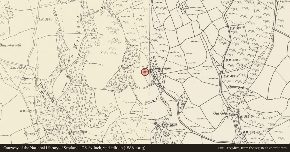
The record
- Designation
- Listed building, Grade II
- Broad class
- Agriculture and Subsistence
- Date of designation
- 12 January 1999
- Locality
- Goitre
- Community
- Llangennech
- Unitary authority
- Carmarthenshire
- Country
- Wales
- Coordinates
- 51.72174, -4.09719
- Cadw reference
- 21101
Slide toward Today to fade the historical sheet and see the modern map underneath.
David Rumsey Map Collection, Stanford LibrariesDavid Rumsey Map Collection, Stanford LibrariesDavid Rumsey Map Collection, Stanford LibrariesDavid Rumsey Map Collection, Stanford LibrariesDavid Rumsey Map Collection, Stanford Libraries
5 historical maps cover this location, the earliest the 1636 map "Cornubia : Devonia, Somersetus, Dorcestria, Wiltonia, Glocestria ..." (David Rumsey Map Collection, Stanford Libraries).
Historical maps covering this location
- 1636 · Cornubia : Devonia, Somersetus, Dorcestria, Wiltonia, Glocestria ... (David Rumsey Map Collection, Stanford Libraries)
- 1891 · Sheet 10. Ordnance Survey of England and Wales. . (David Rumsey Map Collection, Stanford Libraries)
- 1898 · 230 Ammanford (Hills) (David Rumsey Map Collection, Stanford Libraries)
- 1898 · 230 Ammanford (Outline) (David Rumsey Map Collection, Stanford Libraries)
- 1920 · Sheet 100. Llanelly. (David Rumsey Map Collection, Stanford Libraries)
Cadw's description
Location
To the west of the rear yard of Goitre Wen farmhouse, facing north to the farmyard and backing on to the walled garden.
History
Part of a set of probably contemporary farm buildings and domestic offices, the barn carrying the date 1796. The farm was the property of the Lott family and their descendants. It was a gentry farm until the late C19, when the house was subdivided to create a separate farmhouse.
Exterior
Rubble masonry in local stone, including yard walls of the pigsties. Slate roof. The cart sheds are open fronted with timber posts. The pigsties have small yards at front and low lofts above (perhaps henhouses). At the front is the original yard paving in pitched stone.
Reason for designation
Listed as part of a complete set of late C18 or early C19 farm buildings, and part of an intact farmstead group at Goetre Wen.
Nearby in the register
- Goitre Wen Farmyard: Barn RangeAgriculture and Subsistenceunder 1 mi
- Goitre Wen Farmhouse with adjacent Walled Yards and GardenAgriculture and Subsistenceunder 1 mi
- Goitre Wen Stables and Domestic OfficesAgriculture and Subsistenceunder 1 mi
- Bridge over Afon Morlais (partly in Llannon Community)Transportunder 1 mi
Other entries of the same register within about three miles of this one, by straight line.