Cof Cymru: National Historic Assets of Wales · Wales
Milestone near Blaenau Isaf
Llannon, Carmarthenshire, Wales
A Grade II listed building in Blaenau Isaf, Llannon, Carmarthenshire, designated on 12 January 1999.
The record
- Designation
- Listed building, Grade II
- Broad class
- Transport
- Date of designation
- 12 January 1999
- Locality
- Blaenau Isaf
- Community
- Llannon
- Unitary authority
- Carmarthenshire
- Country
- Wales
- Coordinates
- 51.78545, -4.08042
- Cadw reference
- 21083
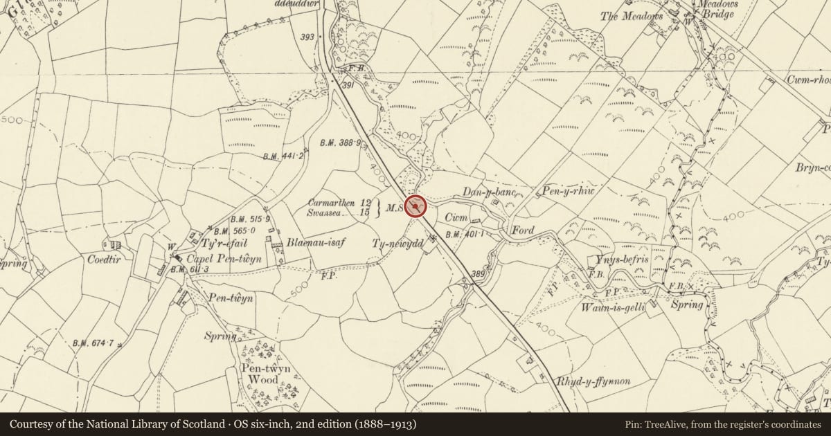
Slide toward Today to fade the historical sheet and see the modern map underneath.
David Rumsey Map Collection, Stanford LibrariesDavid Rumsey Map Collection, Stanford LibrariesDavid Rumsey Map Collection, Stanford LibrariesDavid Rumsey Map Collection, Stanford LibrariesDavid Rumsey Map Collection, Stanford Libraries
5 historical maps cover this location, the earliest the 1860 map "41. Caermathen." (David Rumsey Map Collection, Stanford Libraries).
Historical maps covering this location
- 1860 · 41. Caermathen. (David Rumsey Map Collection, Stanford Libraries)
- 1891 · Sheet 10. Ordnance Survey of England and Wales. . (David Rumsey Map Collection, Stanford Libraries)
- 1898 · 230 Ammanford (Hills) (David Rumsey Map Collection, Stanford Libraries)
- 1898 · 230 Ammanford (Outline) (David Rumsey Map Collection, Stanford Libraries)
- 1901 · Sheet 14. (David Rumsey Map Collection, Stanford Libraries)
Cadw's description
Location
In Pontardulais Road 1km south-east of Crosshands crossroads.
History
The road through Crosshands was part of the Three Commotts Turnpike Trust system established in the late C18.
Exterior
Late C18 milestone of limestone bearing the lettering: "From / [Ca]rmarthen / 12 Miles / To Swansea / 15". The stone is about 700mm high by about 400mm wide, of irregular thickness. The top is roughly rounded.
Reason for designation
Listed as a late C18 milestone of characteristic local type.
Nearby in the register
- Milestone between Crosshands and TumbleTransportunder 1 mi
- Twll y Car Farmhouse and farm-rangeTransportunder 1 mi
- Crosshands Public HallInstitutionalunder 1 mi
- Milestone south of Upper TumbleTransport1 mi
Other entries of the same register within about three miles of this one, by straight line.