Cof Cymru: National Historic Assets of Wales · Wales
Primrose Cottage
Wick, Vale of Glamorgan, Wales
A Grade II listed building in Wick, Vale of Glamorgan, designated on 27 November 1998.
The record
- Designation
- Listed building, Grade II
- Broad class
- Domestic
- Date of designation
- 27 November 1998
- Locality
- Wick
- Community
- Wick
- Unitary authority
- Vale of Glamorgan
- Country
- Wales
- Coordinates
- 51.43806, -3.54921
- Cadw reference
- 20976
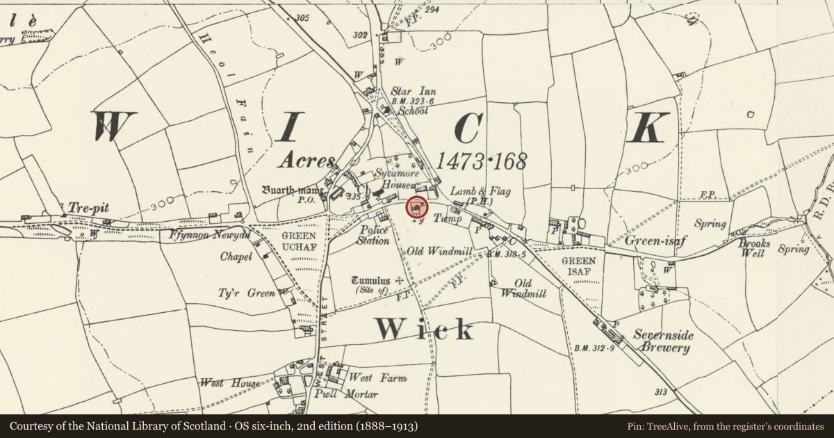
Slide toward Today to fade the historical sheet and see the modern map underneath.
David Rumsey Map Collection, Stanford LibrariesDavid Rumsey Map Collection, Stanford LibrariesDavid Rumsey Map Collection, Stanford LibrariesDavid Rumsey Map Collection, Stanford LibrariesDavid Rumsey Map Collection, Stanford Libraries
5 historical maps cover this location, the earliest the 1636 map "Cornubia : Devonia, Somersetus, Dorcestria, Wiltonia, Glocestria ..." (David Rumsey Map Collection, Stanford Libraries).
Historical maps covering this location
- 1636 · Cornubia : Devonia, Somersetus, Dorcestria, Wiltonia, Glocestria ... (David Rumsey Map Collection, Stanford Libraries)
- 1637 · The fourth table of England. Cornub. Devonia, Somerset etc. (David Rumsey Map Collection, Stanford Libraries)
- 1865 · England and Wales. England No. 6. (David Rumsey Map Collection, Stanford Libraries)
- 1897 · 262 Pontypridd (Hills) (David Rumsey Map Collection, Stanford Libraries)
- 1897 · 262 Pontypridd (Outline) (David Rumsey Map Collection, Stanford Libraries)
Cadw's description
Location
Located on the S side of Church Street, slightly set back from the road and in front of Wick and Marcross Primary School. No. 1 is the L house in the terrace.
Interior
No access to interior at time of inspection (11/12/97).
Reason for designation
Listed as a C19 terrace with well preserved detail, which appears to have earlier origins.
Nearby in the register
- Bluebell CottageDomesticunder 1 mi
- Lamb CottageDomesticunder 1 mi
- Sycamore HouseDomesticunder 1 mi
- Remains of Preaching Cross, Church of St. JamesReligious, Ritual and Funeraryunder 1 mi
Other entries of the same register within about three miles of this one, by straight line.