Cof Cymru: National Historic Assets of Wales · Wales
Centre building of farm-court at Manorafon
Cyngor Bro Dyffryn Cennen, Carmarthenshire, Wales
A Grade II listed building in Bethlehem Road, Llandeilo, Cyngor Bro Dyffryn Cennen, Carmarthenshire, designated on 24 November 1998.
The record
- Designation
- Listed building, Grade II
- Broad class
- Agriculture and Subsistence
- Date of designation
- 24 November 1998
- Locality
- Bethlehem Road
- Town
- Llandeilo
- Community
- Cyngor Bro Dyffryn Cennen
- Unitary authority
- Carmarthenshire
- Country
- Wales
- Coordinates
- 51.89579, -3.95860
- Cadw reference
- 20922
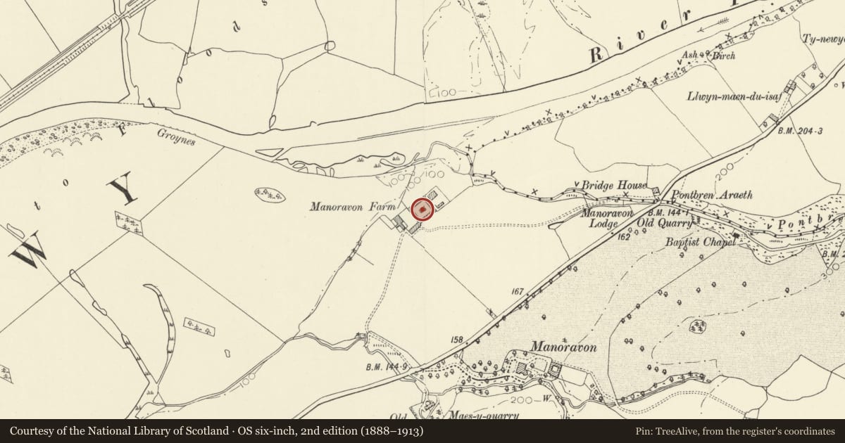
Slide toward Today to fade the historical sheet and see the modern map underneath.
David Rumsey Map Collection, Stanford LibrariesDavid Rumsey Map Collection, Stanford LibrariesDavid Rumsey Map Collection, Stanford LibrariesDavid Rumsey Map Collection, Stanford LibrariesDavid Rumsey Map Collection, Stanford Libraries
5 historical maps cover this location, the earliest the 1860 map "41. Caermathen." (David Rumsey Map Collection, Stanford Libraries).
Historical maps covering this location
- 1860 · 41. Caermathen. (David Rumsey Map Collection, Stanford Libraries)
- 1891 · Sheet 10. Ordnance Survey of England and Wales. . (David Rumsey Map Collection, Stanford Libraries)
- 1898 · 212 Llandovery (Outline) (David Rumsey Map Collection, Stanford Libraries)
- 1898 · 212 Llandovery (Hills) (David Rumsey Map Collection, Stanford Libraries)
- 1901 · Sheet 14. (David Rumsey Map Collection, Stanford Libraries)
Cadw's description
Location
Situated in centre of enclosed farm court at Manorafon.
History
Centre building to enclosed model farm court of c1800 at Manorafon. Marked on 1841 Tithe Map. The building seems to have been a calf-house since the C19, but may not have been that originally. An 1807 sale advertisement mentions stables for 6 horses. The arrangement of doors and wide window openings may indicate that this was originally intended as stabling.
Exterior
Farm-building, latterly calf-house, rubble stone with slate hipped roof. Single storey with matching N and S sides of window, door, window; window, door, window. Stable doors, louvred and shuttered windows, all with stone voussoirs to cambered heads. Two similar windows each end wall. One of doors on S side is blocked.
Interior
Red brick and timber dividing walls to calf-pens. Later C19 wishbone trusses to roof.
Reason for designation
Included as a component part of the important model farm group at Manorafon.
Nearby in the register
- Courtyard of farm buildings at ManorafonAgriculture and Subsistenceunder 1 mi
- Capel BethelReligious, Ritual and Funeraryunder 1 mi
- Barn at Pentre ParrAgriculture and Subsistenceunder 1 mi
- LlyshendyDomesticunder 1 mi
Other entries of the same register within about three miles of this one, by straight line.