Cof Cymru: National Historic Assets of Wales · Wales
Capel Bethel
Cyngor Bro Dyffryn Cennen, Carmarthenshire, Wales
A Grade II listed building in Bethlehem Road, Llandeilo, Cyngor Bro Dyffryn Cennen, Carmarthenshire, designated on 24 November 1998.
The record
- Designation
- Listed building, Grade II
- Broad class
- Religious, Ritual and Funerary
- Date of designation
- 24 November 1998
- Locality
- Bethlehem Road
- Town
- Llandeilo
- Community
- Cyngor Bro Dyffryn Cennen
- Unitary authority
- Carmarthenshire
- Country
- Wales
- Coordinates
- 51.89527, -3.94904
- Cadw reference
- 20904
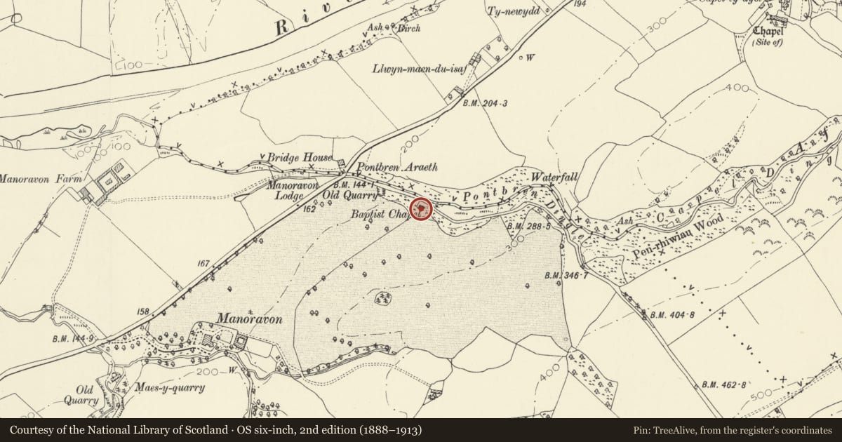
Slide toward Today to fade the historical sheet and see the modern map underneath.
David Rumsey Map Collection, Stanford LibrariesDavid Rumsey Map Collection, Stanford LibrariesDavid Rumsey Map Collection, Stanford LibrariesDavid Rumsey Map Collection, Stanford LibrariesDavid Rumsey Map Collection, Stanford Libraries
5 historical maps cover this location, the earliest the 1860 map "41. Caermathen." (David Rumsey Map Collection, Stanford Libraries).
Historical maps covering this location
- 1860 · 41. Caermathen. (David Rumsey Map Collection, Stanford Libraries)
- 1891 · Sheet 10. Ordnance Survey of England and Wales. . (David Rumsey Map Collection, Stanford Libraries)
- 1898 · 212 Llandovery (Outline) (David Rumsey Map Collection, Stanford Libraries)
- 1898 · 212 Llandovery (Hills) (David Rumsey Map Collection, Stanford Libraries)
- 1901 · Sheet 14. (David Rumsey Map Collection, Stanford Libraries)
Cadw's description
Location
Situated in isolated riverside position on S bank of Afon Araeth down track off Llangadog road some 4 km NE of Ffairfach.
History
Baptist chapel of 1842, altered from long-wall to gable-end entry in later C19 when interior was also refitted.
Exterior
Chapel, whitewashed rubble stone with slate roof. Originally with entrance on lateral facade. Two long arched windows with later C19 glazing in centre and two outer blocked arched doors. Stone memorial attached to front wall centre, to Thomas Thomas of Maesnewydd, d 1844 with ogee top inscribed 'Life How Short Eternity How Long'. S end wall has late C19 projecting verges, and one original upper window with stone voussoirs, over ground floor late C19 or early C20 central door and flanking windows, all with brick heads. Rear wall has 2 long arched windows with brick heads and later C19 glazing. N end has 2 similar long arched windows.
Interior
Galleried interior with lobby at S end. Gallery has canted angles, modillion cornice and panels alternately long and square. Reeded iron columns. Pulpit on N end wall with 3-sided front and quatrefoil panels. Pews in 3 blocks, those each side of pulpit facing in.
Reason for designation
Included as a small rural chapel of the earlier C19, in exceptional isolated location.
Nearby in the register
- Centre building of farm-court at ManorafonAgriculture and Subsistenceunder 1 mi
- Courtyard of farm buildings at ManorafonAgriculture and Subsistenceunder 1 mi
- Barn at Pentre ParrAgriculture and Subsistenceunder 1 mi
- Bryngwyn Standing StoneStanding Stone1 mi
Other entries of the same register within about three miles of this one, by straight line.