Cof Cymru: National Historic Assets of Wales · Wales
Milestone on B4300
Cyngor Bro Dyffryn Cennen, Carmarthenshire, Wales
A Grade II listed building in Ffairfach, Llandeilo, Cyngor Bro Dyffryn Cennen, Carmarthenshire, designated on 24 November 1998.
The record
- Designation
- Listed building, Grade II
- Broad class
- Transport
- Date of designation
- 24 November 1998
- Locality
- Ffairfach
- Town
- Llandeilo
- Community
- Cyngor Bro Dyffryn Cennen
- Unitary authority
- Carmarthenshire
- Country
- Wales
- Coordinates
- 51.86851, -4.02194
- Cadw reference
- 20909
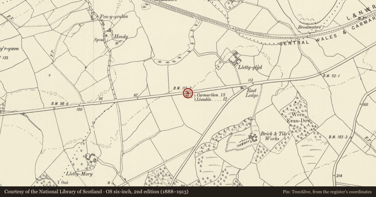
Slide toward Today to fade the historical sheet and see the modern map underneath.
David Rumsey Map Collection, Stanford LibrariesDavid Rumsey Map Collection, Stanford LibrariesDavid Rumsey Map Collection, Stanford LibrariesDavid Rumsey Map Collection, Stanford LibrariesDavid Rumsey Map Collection, Stanford Libraries
5 historical maps cover this location, the earliest the 1860 map "41. Caermathen." (David Rumsey Map Collection, Stanford Libraries).
Historical maps covering this location
- 1860 · 41. Caermathen. (David Rumsey Map Collection, Stanford Libraries)
- 1891 · Sheet 10. Ordnance Survey of England and Wales. . (David Rumsey Map Collection, Stanford Libraries)
- 1898 · 230 Ammanford (Hills) (David Rumsey Map Collection, Stanford Libraries)
- 1898 · 230 Ammanford (Outline) (David Rumsey Map Collection, Stanford Libraries)
- 1901 · Sheet 14. (David Rumsey Map Collection, Stanford Libraries)
Cadw's description
Location
Situated on S side of B4300 some 2km W of Ffairfach, and some 250m W of East Lodge.
History
Milestone probably of early C19 on former Carmarthen to Llandeilo turnpike road.
Exterior
Milestone probably early C19, whitewashed stone with black painted incised inscription, finely carved, reading 'From Carmarthen 13 Miles To Llandilo 1 3/4 th'.
Reason for designation
Included as a well-lettered milestone reflecting the transport history of the region.
Nearby in the register
- East LodgeDomesticunder 1 mi
- Old Dynevor CastleDefenceunder 1 mi
- Castell DinefwrCastleunder 1 mi
- Pont-y-wernTransportunder 1 mi
Other entries of the same register within about three miles of this one, by straight line.