Cof Cymru: National Historic Assets of Wales · Wales
The Old Chapel
The Vale of Grwyney, Powys, Wales
A Grade II listed building in Grwyne Fechan, The Vale of Grwyney, Powys, designated on 19 November 1998.
The record
- Designation
- Listed building, Grade II
- Broad class
- Religious, Ritual and Funerary
- Date of designation
- 19 November 1998
- Locality
- Grwyne Fechan
- Community
- The Vale of Grwyney
- Unitary authority
- Powys
- Country
- Wales
- Coordinates
- 51.90596, -3.10871
- Cadw reference
- 20857
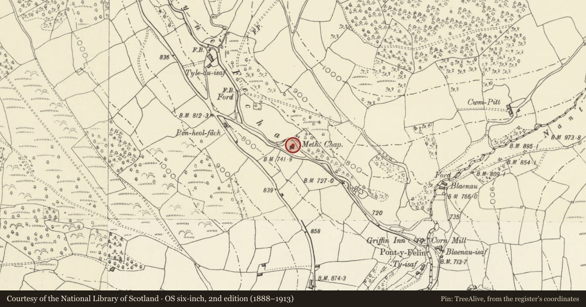
Slide toward Today to fade the historical sheet and see the modern map underneath.
David Rumsey Map Collection, Stanford LibrariesDavid Rumsey Map Collection, Stanford LibrariesDavid Rumsey Map Collection, Stanford LibrariesDavid Rumsey Map Collection, Stanford LibrariesDavid Rumsey Map Collection, Stanford Libraries
5 historical maps cover this location, the earliest the 1636 map "Cornubia : Devonia, Somersetus, Dorcestria, Wiltonia, Glocestria ..." (David Rumsey Map Collection, Stanford Libraries).
Historical maps covering this location
- 1636 · Cornubia : Devonia, Somersetus, Dorcestria, Wiltonia, Glocestria ... (David Rumsey Map Collection, Stanford Libraries)
- 1856 · 42. Brecon. (David Rumsey Map Collection, Stanford Libraries)
- 1895 · Sheet 11. Ordnance Survey of England and Wales. (David Rumsey Map Collection, Stanford Libraries)
- 1896 · 214 Talgarth (Hills) (David Rumsey Map Collection, Stanford Libraries)
- 1901 · Sheet 14. (David Rumsey Map Collection, Stanford Libraries)
Cadw's description
Location
Approximately 3.3km N of Llanbedr church, on N side of a minor road and on R bank of Grwyne Fechan.
History
C16 chapel of ease belonging to Talgarth parish. Abandoned by C19, it was converted to a nonconformist chapel 1880 with new seating and roof, a new E window and W door. Became an outdoor education centre late C20.
Exterior
Single-cell chapel with battered walls of rubble sandstone (with traces of limewash) and pantile roof with an added brick stack L of centre. The S wall has a Tudor-headed doorway L with a stop-chamfer surround and a boarded door. A 3-light window to centre has replaced round-headed lights (probably replacing earlier cusped lights), R of which is a segmental-headed priest's doorway blocked to form a window. The E wall has a pointed-arched horned sash window inserted 1880 and replacing an earlier narrower E window. The N wall has a single 1-light window in a dressed stone surround. The W wall has a segmental-headed doorway of 1880, with a later half-lit door, and a small lancet offset to R below the apex with inserted casement (and which formerly housed the bell).
Interior
Four-bay roof of king posts with raking struts, of 1880. Otherwise the interior is converted for its present use.
Reason for designation
Included, notwithstanding recent conversion, for its retention of medieval detail and for the special interest of a remote chapel converted for nonconformist use.
Nearby in the register
- The MillDomesticunder 1 mi
- Former Flour and Grist Mill at The MillAgriculture and Subsistenceunder 1 mi
- Pont Cwm BanwTransportunder 1 mi
- Road bridge at The BontTransportunder 1 mi
Other entries of the same register within about three miles of this one, by straight line.