Cof Cymru: National Historic Assets of Wales · Wales
Brick Sheds of former Paper Mill at Usk Vale Mill
The Vale of Grwyney, Powys, Wales
A Grade II listed building in Glangrwyne, The Vale of Grwyney, Powys, designated on 19 November 1998.
The record
- Designation
- Listed building, Grade II
- Broad class
- Commercial
- Date of designation
- 19 November 1998
- Locality
- Glangrwyne
- Community
- The Vale of Grwyney
- Unitary authority
- Powys
- Country
- Wales
- Coordinates
- 51.83808, -3.10521
- Cadw reference
- 20852
Slide toward Today to fade the historical sheet and see the modern map underneath.
David Rumsey Map Collection, Stanford LibrariesDavid Rumsey Map Collection, Stanford LibrariesDavid Rumsey Map Collection, Stanford LibrariesDavid Rumsey Map Collection, Stanford LibrariesDavid Rumsey Map Collection, Stanford Libraries
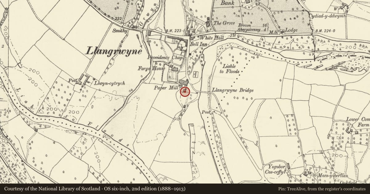
5 historical maps cover this location, the earliest the 1636 map "Cornubia : Devonia, Somersetus, Dorcestria, Wiltonia, Glocestria ..." (David Rumsey Map Collection, Stanford Libraries).
Historical maps covering this location
- 1636 · Cornubia : Devonia, Somersetus, Dorcestria, Wiltonia, Glocestria ... (David Rumsey Map Collection, Stanford Libraries)
- 1856 · 42. Brecon. (David Rumsey Map Collection, Stanford Libraries)
- 1898 · 232 Abergavenny (Hills) (David Rumsey Map Collection, Stanford Libraries)
- 1898 · 232 Abergavenny (Outline) (David Rumsey Map Collection, Stanford Libraries)
- 1901 · Sheet 14. (David Rumsey Map Collection, Stanford Libraries)
Cadw's description
Location
Immediately S of former mill and on W side of entrance to Lower Mill House.
History
Late C19 or early C20, and part of the expansion of Usk Paper Mills after their acquisition by Beckwith & Co in 1888. The mill closed c1940 and is now an agricultural vehicle repair shop. The sheds were probably built originally for vehicle storage.
Exterior
Consisting of 5 unequal bays facing a yard to N, of brick with corrugated iron roofs (the 2nd bay from the L end has a partially collapsed roof). The bay on R (W) side is wider, the 2 bays to L (E) have asymmetrical gables. The bay at the R end has a sliding boarded door, L of which the bay has a wide opening and a boarded gable. The central bay has a boarded gable, L of which is a short link to the two L bays, which have double boarded doors under wooden lintels. The L end bay has a pivoting window above the doorway, and a small lean-to with boarded door in the L side wall.
The rear is obscured by vegetation.
Interior
Not inspected at time of survey (February 1998).
Reason for designation
Included for group value with the former Glangrwyne Paper Mill, a rare survival of a specialised building type.
Nearby in the register
- Former Paper Mill at Usk Vale MillCommercialunder 1 mi
- Forge HouseDomesticunder 1 mi
- Bell HotelCommercialunder 1 mi
- White HallDomesticunder 1 mi
Other entries of the same register within about three miles of this one, by straight line.