Cof Cymru: National Historic Assets of Wales · Wales
Driveway bridge at Voelas (partly in Bro Garmon community)
Pentrefoelas, Conwy, Wales
A Grade II listed building in Voelas, Pentrefoelas, Conwy, designated on 19 October 1998.
The record
- Designation
- Listed building, Grade II
- Broad class
- Gardens, Parks and Urban Spaces
- Date of designation
- 19 October 1998
- Locality
- Voelas
- Town
- Pentrefoelas
- Community
- Pentrefoelas
- Unitary authority
- Conwy
- Country
- Wales
- Coordinates
- 53.04881, -3.71791
- Cadw reference
- 20608
Slide toward Today to fade the historical sheet and see the modern map underneath.
David Rumsey Map Collection, Stanford LibrariesDavid Rumsey Map Collection, Stanford LibrariesLlyfrgell Genedlaethol Cymru – The National Library of WalesDavid Rumsey Map Collection, Stanford LibrariesDavid Rumsey Map Collection, Stanford Libraries
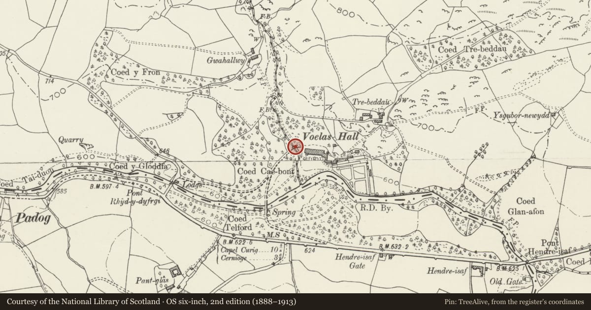
5 historical maps cover this location, the earliest the 1795 map "To Sir Watkin Williams-Wynn Bart ... the map of the six counties of North Wales is most humbly inscribed by his obedient humble servant" (Llyfrgell Genedlaethol Cymru – The National Library of Wales).
Historical maps covering this location
- 1795 · To Sir Watkin Williams-Wynn Bart ... the map of the six counties of North Wales is most… (Llyfrgell Genedlaethol Cymru – The National Library of Wales)
- 1830 · V.3:11-15:XV. Britisches Reich. A. Kon: England. b. Frstenthum Wales: Shire: 37-40 (David Rumsey Map Collection, Stanford Libraries)
- 1883 · Watershed map England, Wales 3. (David Rumsey Map Collection, Stanford Libraries)
- 1898 · 120 Corwen (Hills) (David Rumsey Map Collection, Stanford Libraries)
- 1901 · Sheet 9 and 10. (David Rumsey Map Collection, Stanford Libraries)
Cadw's description
Location
The drive to Voelas crosses a bridge over the Nant-y-coed running N-S and forming the community boundary with Bro Garmon immediately to W of the house.
History
Probably built in the early-mid C19, perhaps in connection with the villa called Lima built on the same site in 1813-1819 for the Hon. Charles Finch.
Exterior
The bridge is constructed of rubble stonework. One tall stilted arch spans the stream between high banks, formed of radial voussoirs rising to a central keystone and outlined by a regulating course. To the W, a sharply raking buttress, and another flood arch of similar proportions, but rising from the bank top. Horizontal string course and flush parapet flush coped with stone. The driveway is level.
Reason for designation
Included as a well-preserved C19 feature within the Registered park at Voelas, of group value with the Grade II* Voelas house.
Nearby in the register
- VoelasDomesticunder 1 mi
- Summerhouse at VoelasGardens, Parks and Urban Spacesunder 1 mi
- Brohomagli Stone (Now In Voelas Hall)Inscribed Stoneunder 1 mi
- Laundry, stable and bothy at VoelasDomesticunder 1 mi
Other entries of the same register within about three miles of this one, by straight line.