Cof Cymru: National Historic Assets of Wales · Wales
Laundry, stable and bothy at Voelas
Pentrefoelas, Conwy, Wales
A Grade II listed building in Voelas, Pentrefoelas, Conwy, designated on 19 October 1998.
The record
- Designation
- Listed building, Grade II
- Broad class
- Domestic
- Date of designation
- 19 October 1998
- Locality
- Voelas
- Town
- Pentrefoelas
- Community
- Pentrefoelas
- Unitary authority
- Conwy
- Country
- Wales
- Coordinates
- 53.04852, -3.71656
- Cadw reference
- 20587
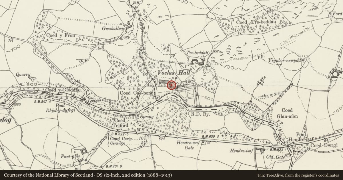
Slide toward Today to fade the historical sheet and see the modern map underneath.
David Rumsey Map Collection, Stanford LibrariesDavid Rumsey Map Collection, Stanford LibrariesLlyfrgell Genedlaethol Cymru – The National Library of WalesDavid Rumsey Map Collection, Stanford LibrariesDavid Rumsey Map Collection, Stanford Libraries
5 historical maps cover this location, the earliest the 1795 map "To Sir Watkin Williams-Wynn Bart ... the map of the six counties of North Wales is most humbly inscribed by his obedient humble servant" (Llyfrgell Genedlaethol Cymru – The National Library of Wales).
Historical maps covering this location
- 1795 · To Sir Watkin Williams-Wynn Bart ... the map of the six counties of North Wales is most… (Llyfrgell Genedlaethol Cymru – The National Library of Wales)
- 1830 · V.3:11-15:XV. Britisches Reich. A. Kon: England. b. Frstenthum Wales: Shire: 37-40 (David Rumsey Map Collection, Stanford Libraries)
- 1883 · Watershed map England, Wales 3. (David Rumsey Map Collection, Stanford Libraries)
- 1898 · 120 Corwen (Hills) (David Rumsey Map Collection, Stanford Libraries)
- 1901 · Sheet 9 and 10. (David Rumsey Map Collection, Stanford Libraries)
Cadw's description
Location
The building containing the laundry, garage, stable and bothy is set transversely at the E end of the terrace across the main S front of the house.
History
Built in the mid C19 as a service range to the earlier house built 1856-1858 for Charles Wynn-Finch at Voelas. The Brochmael stone affixed to the wall is C5 or early C6, from a nearby Early Christian cemetery.
Exterior
Built of rendered stone, with slate roofs and crested ridges, one section over the laundry raised as a hipped ventilated saddleback. One storey with attic accommodation over. On the ground floor facing the terrace, a lean-to verandah supported on bracketed timber posts. Boarded door. The upper floor is lit by windows in two steeply gabled raised dormers. The bothy, at the S end is built of squared rubble, and forms a quadrant on plan to join the S range of the stables. Three 2-light windows and a dentilled cornice.
Within the verandah, is the Brochmael Stone. This was found in 1821 274.32m E of Pont Hendre-isaf in an early-Christian cemetery of c40 graves during Telford's re-engineering of the road. It is fixed by metal cramps to the wall. Scheduled as an Ancient Monument (No 8/0844/DE96(CON)R) under its proper name of the Brohomagli Stone.
The rear has two similar raised dormers with timber casement windows. Two smaller windows on the ground floor and two carriage houses, now garages.
Reason for designation
Included as a typical mid C19 range of estate buildings, but largely for group value with the Grade II* house and gardens at Voelas.
Nearby in the register
- Brohomagli Stone (Now In Voelas Hall)Inscribed Stoneunder 1 mi
- Summerhouse at VoelasGardens, Parks and Urban Spacesunder 1 mi
- Carriage house at VoelasDomesticunder 1 mi
- VoelasDomesticunder 1 mi
Other entries of the same register within about three miles of this one, by straight line.