Cof Cymru: National Historic Assets of Wales · Wales
Dovecote at Dinam
Rhosyr, Isle of Anglesey, Wales
A Grade II listed building in Dinam, Rhosyr, Isle of Anglesey, designated on 19 October 1998.
The record
- Designation
- Listed building, Grade II
- Broad class
- Domestic
- Date of designation
- 19 October 1998
- Locality
- Dinam
- Community
- Rhosyr
- Unitary authority
- Isle of Anglesey
- Country
- Wales
- Coordinates
- 53.19499, -4.31684
- Cadw reference
- 20561
Slide toward Today to fade the historical sheet and see the modern map underneath.
David Rumsey Map Collection, Stanford LibrariesDavid Rumsey Map Collection, Stanford LibrariesDavid Rumsey Map Collection, Stanford LibrariesDavid Rumsey Map Collection, Stanford LibrariesDavid Rumsey Map Collection, Stanford Libraries
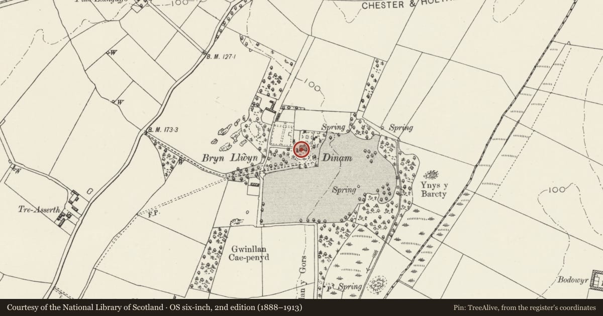
5 historical maps cover this location, the earliest the 1883 map "Watershed map England, Wales 3." (David Rumsey Map Collection, Stanford Libraries).
Historical maps covering this location
- 1883 · Watershed map England, Wales 3. (David Rumsey Map Collection, Stanford Libraries)
- 1896 · Sheet 7. Ordnance Survey of England and Wales. (David Rumsey Map Collection, Stanford Libraries)
- 1899 · 105 Carnarvon (Hills) (David Rumsey Map Collection, Stanford Libraries)
- 1901 · Sheet 9 and 10. (David Rumsey Map Collection, Stanford Libraries)
- 1919 · Sheet 41. Anglesey. (David Rumsey Map Collection, Stanford Libraries)
Cadw's description
Location
Located at the end of a private driveway off the SE side of the B4419, NE of Llangaffo and c800m NE of the Church of St Caffo. The dovecote lies directly SW of the main house.
History
Possibly C18, contemporary with the house and other associated outbuildings; the dovecote was later used to house a 9-holer privy.
Exterior
A single-storey dovecote; square in plan, with lean-to addition to the rear (W). Built of rubble masonry; pyramidal roof of small slates (forming a catslide over the lean-to addition), with slightly projecting eaves with dog-tooth course below, tiled hips and timber glover with pyramidal roof at the apex. The entrance is in the E wall, a central square-headed doorway with flat arched brick lintel. Flanking the entrance are slightly recessed, 4-pane fixed light windows with slate sills. Above the entrance is a square, slightly recessed, decorated wood panel; a circular, recessed window with quarter panes in the centre with a moulded surround and fleur de lys in each corner. The E wall also has an eaves course of diagonally set bricks. To the rear of the right (N) return is a 16-pane fixed light, and to the rear (W) of the building is the lean-to addition with entry through a square-headed doorway in the N wall.
Interior
Formerly lofted, now with boarded ceiling. The inner face of the decorative panel over the doorway has a square, inward opening, inner window.
Reason for designation
Listed as a good example of a C18 dovecote; forming a group with the adjacent Dinam and associated outbuildings.
Nearby in the register
- DinamDomesticunder 1 mi
- Cartshed and game larder at DinamDomesticunder 1 mi
- Stables and granary at DinamAgriculture and Subsistenceunder 1 mi
- Wall of enclosed garden of Dinam and gatewayDomesticunder 1 mi
Other entries of the same register within about three miles of this one, by straight line.