Cof Cymru: National Historic Assets of Wales · Wales
Lychgate in churchyard of St Gastyn
Llangors, Powys, Wales
A Grade II listed building in Llangasty Tal-y-llyn, Llangors, Powys, designated on 21 August 1998.
The record
- Designation
- Listed building, Grade II
- Broad class
- Religious, Ritual and Funerary
- Date of designation
- 21 August 1998
- Locality
- Llangasty Tal-y-llyn
- Community
- Llangors
- Unitary authority
- Powys
- Country
- Wales
- Coordinates
- 51.92676, -3.26224
- Cadw reference
- 20339
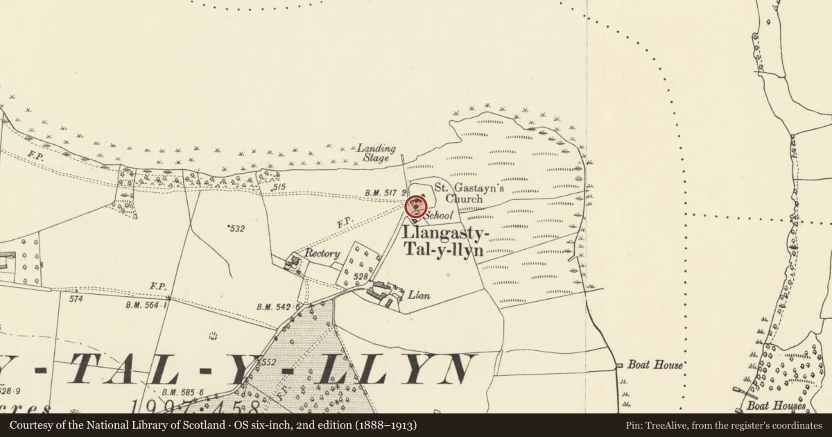
Slide toward Today to fade the historical sheet and see the modern map underneath.
David Rumsey Map Collection, Stanford LibrariesDavid Rumsey Map Collection, Stanford LibrariesDavid Rumsey Map Collection, Stanford LibrariesDavid Rumsey Map Collection, Stanford LibrariesDavid Rumsey Map Collection, Stanford Libraries
5 historical maps cover this location, the earliest the 1608 map "(13) Cambriae Typus." (David Rumsey Map Collection, Stanford Libraries).
Historical maps covering this location
- 1608 · (13) Cambriae Typus. (David Rumsey Map Collection, Stanford Libraries)
- 1636 · Cornubia : Devonia, Somersetus, Dorcestria, Wiltonia, Glocestria ... (David Rumsey Map Collection, Stanford Libraries)
- 1856 · 42. Brecon. (David Rumsey Map Collection, Stanford Libraries)
- 1896 · 214 Talgarth (Hills) (David Rumsey Map Collection, Stanford Libraries)
- 1901 · Sheet 14. (David Rumsey Map Collection, Stanford Libraries)
Cadw's description
Location
Forming the W entrance to the churchyard and adjacent to The Old School.
History
Almost certainly designed by JL Pearson 1850 as part of his extensive development of the Treberfydd estate for Robert Raikes. The church and the adjacent school were both built by Pearson at an early stage in the plan to provide a focus for worship and education in the neighbourhood.
Exterior
Lychgate of timber set on an ashlar and rubble saddleback plinth wall with a hipped plain tile roof with terracotta ridge and slender iron crucifix finial. Roof is supported by deep moulded braces; 2 internal bays with trefoil headed mouldings and heavy transoms. Gates of wood with quatrefoils below rail and iron with long hinges. Stone flag floor. Adjoining churchyard wall at right angles has simpler saddleback coping.
Reason for designation
Included for group value with the church and Old School House and as an integral part of the redevelopment of this area by Pearson.
Nearby in the register
- Church of St GastynReligious, Ritual and Funeraryunder 1 mi
- Old School House (also known as Yr Hen Ysgol)Domesticunder 1 mi
- Walled garden at TreberfyddGardens, Parks and Urban Spacesunder 1 mi
- Entrance gateway and wall at TreberfyddGardens, Parks and Urban Spacesunder 1 mi
Other entries of the same register within about three miles of this one, by straight line.