Cof Cymru: National Historic Assets of Wales · Wales
Entrance gateway and wall at Treberfydd
Llangors, Powys, Wales
A Grade II listed building in Treberfydd, Llangors, Powys, designated on 21 August 1998.
The record
- Designation
- Listed building, Grade II
- Broad class
- Gardens, Parks and Urban Spaces
- Date of designation
- 21 August 1998
- Locality
- Treberfydd
- Community
- Llangors
- Unitary authority
- Powys
- Country
- Wales
- Coordinates
- 51.92135, -3.26693
- Cadw reference
- 20334
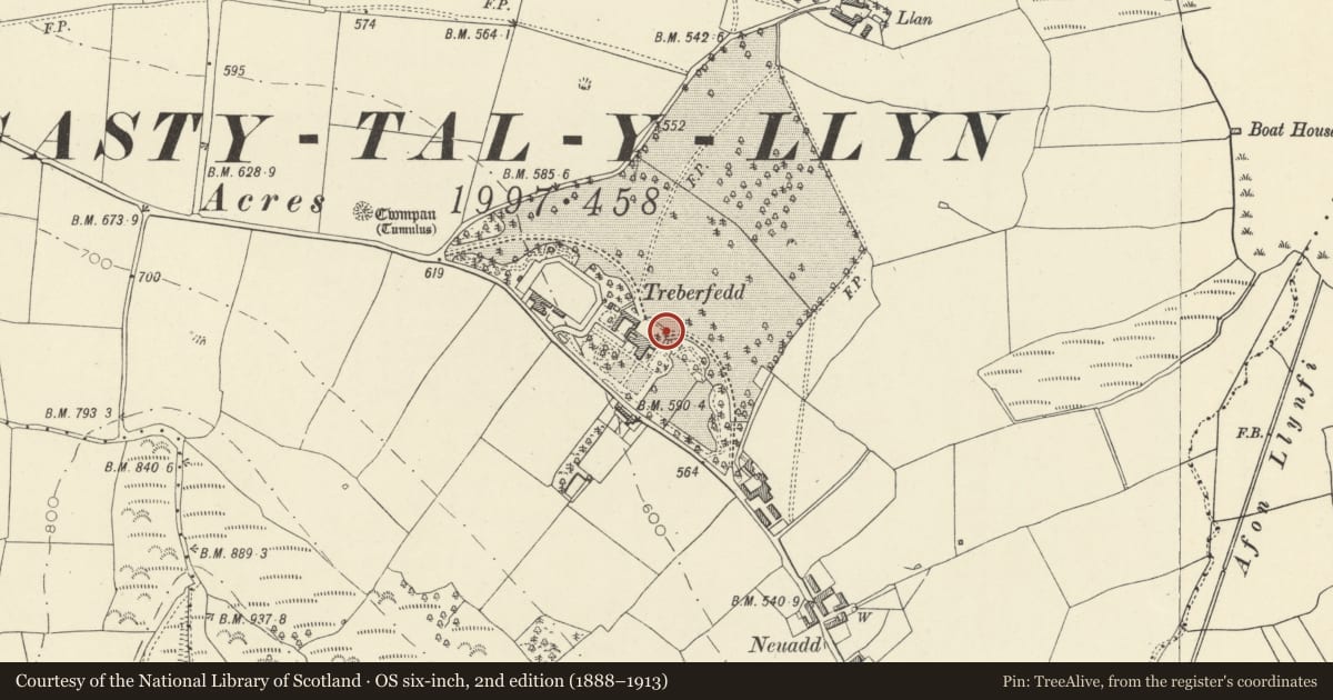
Slide toward Today to fade the historical sheet and see the modern map underneath.
David Rumsey Map Collection, Stanford LibrariesDavid Rumsey Map Collection, Stanford LibrariesDavid Rumsey Map Collection, Stanford LibrariesDavid Rumsey Map Collection, Stanford LibrariesDavid Rumsey Map Collection, Stanford Libraries
5 historical maps cover this location, the earliest the 1608 map "(13) Cambriae Typus." (David Rumsey Map Collection, Stanford Libraries).
Historical maps covering this location
- 1608 · (13) Cambriae Typus. (David Rumsey Map Collection, Stanford Libraries)
- 1636 · Cornubia : Devonia, Somersetus, Dorcestria, Wiltonia, Glocestria ... (David Rumsey Map Collection, Stanford Libraries)
- 1856 · 42. Brecon. (David Rumsey Map Collection, Stanford Libraries)
- 1896 · 214 Talgarth (Hills) (David Rumsey Map Collection, Stanford Libraries)
- 1901 · Sheet 14. (David Rumsey Map Collection, Stanford Libraries)
Cadw's description
Location
The curved wall bounds the front entrance courtyard facing the park and lake with gateways to drives at each side.
History
Part of the redevelopment of Treberfydd by J L Pearson c1850 for Robert Raikes the owner.
Exterior
Courtyard wall extends from the stable range to the garden wall which adjoins the main house; in plan a large canted bay. Of coursed rubble formerly colour-washed with saddleback coping, stepped up to garden wall. Gateways have piers with steep pyramidal caps, inset quatrefoil decoration and battered plinths. Decorative wooden gates to E have spear stanchions; lost boarding on one side.
Reason for designation
Included as part of the 1850s development, specially important for the setting of the house.
Group value with this and all other buildings at Treberfydd.
Nearby in the register
- Treberfydd (also known as Treberfedd)Domesticunder 1 mi
- Walled terrace and steps in Treberfydd gardenGardens, Parks and Urban Spacesunder 1 mi
- Stable courtyard at TreberfyddDomesticunder 1 mi
- Walled garden at TreberfyddGardens, Parks and Urban Spacesunder 1 mi
Other entries of the same register within about three miles of this one, by straight line.