Cof Cymru: National Historic Assets of Wales · Wales
Barn and attached byre at Nant y Felin Uchaf
Llangors, Powys, Wales
A Grade II listed building in Cathedine, Llangors, Powys, designated on 21 August 1998.
The record
- Designation
- Listed building, Grade II
- Broad class
- Agriculture and Subsistence
- Date of designation
- 21 August 1998
- Locality
- Cathedine
- Community
- Llangors
- Unitary authority
- Powys
- Country
- Wales
- Coordinates
- 51.91075, -3.24349
- Cadw reference
- 20314
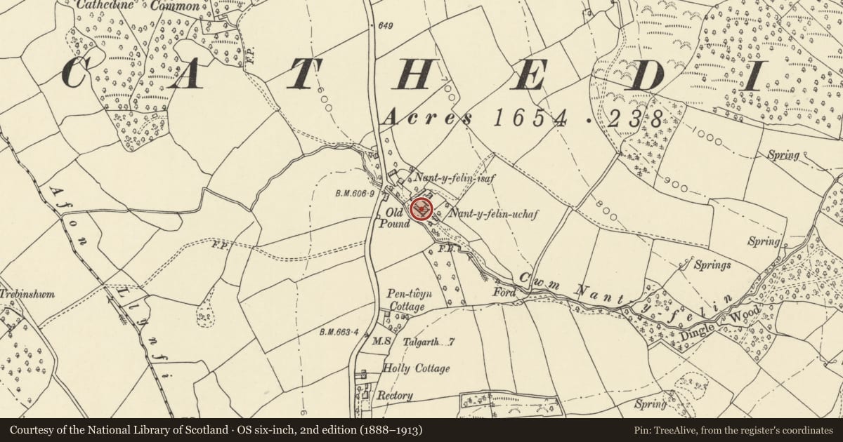
Slide toward Today to fade the historical sheet and see the modern map underneath.
David Rumsey Map Collection, Stanford LibrariesDavid Rumsey Map Collection, Stanford LibrariesDavid Rumsey Map Collection, Stanford LibrariesDavid Rumsey Map Collection, Stanford LibrariesDavid Rumsey Map Collection, Stanford Libraries
5 historical maps cover this location, the earliest the 1636 map "Cornubia : Devonia, Somersetus, Dorcestria, Wiltonia, Glocestria ..." (David Rumsey Map Collection, Stanford Libraries).
Historical maps covering this location
- 1636 · Cornubia : Devonia, Somersetus, Dorcestria, Wiltonia, Glocestria ... (David Rumsey Map Collection, Stanford Libraries)
- 1856 · 42. Brecon. (David Rumsey Map Collection, Stanford Libraries)
- 1895 · Sheet 11. Ordnance Survey of England and Wales. (David Rumsey Map Collection, Stanford Libraries)
- 1896 · 214 Talgarth (Hills) (David Rumsey Map Collection, Stanford Libraries)
- 1901 · Sheet 14. (David Rumsey Map Collection, Stanford Libraries)
Cadw's description
Location
Part of a group of buildings at Nant y Felin farm reached by a short track from the road between Bwlch and Cathedine, this L shaped range bordering Cwm Nantyfelin.
History
Probably an C18 barn that appears to have been enlarged in early C19 by the addition of the large porch; the masonry of the end unit of the attached cowbyre appears to be later than the higher unit.
Exterior
Large barn of stone rubble with some dressed stone dressings and mostly Welsh slate roof: attached at right angles is the cowbyre range on two levels partly of snecked stone and with corrugated roof. Barn has 6 bays with opposing double doors, those to front in a large gabled porch with oculus above; 4 rows of ventilation slits to gable end. Lean-tos attached to front either side of porch. Attached to right is 2 unit cowbyre range entered from farmyard front and from rear at different levels; ventilation slits to gable end; to rear smaller ventilators to upper unit and sash windows and door to lower. The range stands at the lower end of the farmyard, itself creating a small yard; the farmhouse is higher up and opposite is a range with brick dressings extending to cart bays at lower level.
Interior
Barn has pegged trusses of tie beam with collar. Cowbyre has A frame roof with mangers in place in lower unit.
Reason for designation
Included as a traditional regional barn and cow-byre range with an unusually imposing porch bay.
Nearby in the register
- Upper CathedineDomesticunder 1 mi
- Cathedine HillDomesticunder 1 mi
- Shortreed monument in the churchyard to SW of church of St MichaelCommemorativeunder 1 mi
- Vaughan monument in the churchyard to S side of church of St MichaelCommemorativeunder 1 mi
Other entries of the same register within about three miles of this one, by straight line.