Cof Cymru: National Historic Assets of Wales · Wales
Shortreed monument in the churchyard to SW of church of St Michael
Llangors, Powys, Wales
A Grade II listed building in Cathedine, Llangors, Powys, designated on 21 August 1998.
The record
- Designation
- Listed building, Grade II
- Broad class
- Commemorative
- Date of designation
- 21 August 1998
- Locality
- Cathedine
- Community
- Llangors
- Unitary authority
- Powys
- Country
- Wales
- Coordinates
- 51.91836, -3.24680
- Cadw reference
- 20303
Slide toward Today to fade the historical sheet and see the modern map underneath.
David Rumsey Map Collection, Stanford LibrariesDavid Rumsey Map Collection, Stanford LibrariesDavid Rumsey Map Collection, Stanford LibrariesDavid Rumsey Map Collection, Stanford LibrariesDavid Rumsey Map Collection, Stanford Libraries
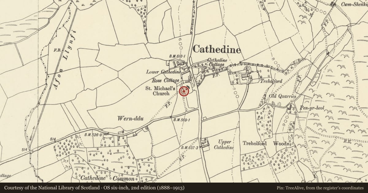
5 historical maps cover this location, the earliest the 1636 map "Cornubia : Devonia, Somersetus, Dorcestria, Wiltonia, Glocestria ..." (David Rumsey Map Collection, Stanford Libraries).
Historical maps covering this location
- 1636 · Cornubia : Devonia, Somersetus, Dorcestria, Wiltonia, Glocestria ... (David Rumsey Map Collection, Stanford Libraries)
- 1856 · 42. Brecon. (David Rumsey Map Collection, Stanford Libraries)
- 1895 · Sheet 11. Ordnance Survey of England and Wales. (David Rumsey Map Collection, Stanford Libraries)
- 1896 · 214 Talgarth (Hills) (David Rumsey Map Collection, Stanford Libraries)
- 1901 · Sheet 14. (David Rumsey Map Collection, Stanford Libraries)
Cadw's description
Location
Near the SW boundary of the churchyard.
History
Monument to Margaret Shortreed d 1851 husband of David Brown of Roxburgh and son Patrick d 1859 at Coedycymmer.
Exterior
A tall square sandstone pier on a deep stepped plinth; entablature with decorative frieze surmounted by a tall draped urn; inscriptions on N and W faces The monument stands in a tall enclosure of slender iron railings in two tiers with spear finials, urns to corner stanchions.
Reason for designation
Included for group value with the church and other churchyard monuments as an elegant mid C19 monument.
Nearby in the register
- Vaughan monument in the churchyard to S side of church of St MichaelCommemorativeunder 1 mi
- Church of St MichaelReligious, Ritual and Funeraryunder 1 mi
- Gunter monuments in the churchyard at E end of church of St MichaelCommemorativeunder 1 mi
- Lower Cathedine farmhouse and attached farm range to W.Domesticunder 1 mi
Other entries of the same register within about three miles of this one, by straight line.