Cof Cymru: National Historic Assets of Wales · Wales
Dyffryn Elwy
Llanfair Talhaiarn, Conwy, Wales
A Grade II listed building in Llanfair Talhaiarn, Conwy, designated on 22 July 1998.
The record
- Designation
- Listed building, Grade II
- Broad class
- Domestic
- Date of designation
- 22 July 1998
- Locality
- Llanfair Talhaiarn
- Community
- Llanfair Talhaiarn
- Unitary authority
- Conwy
- Country
- Wales
- Coordinates
- 53.21955, -3.61092
- Cadw reference
- 20156
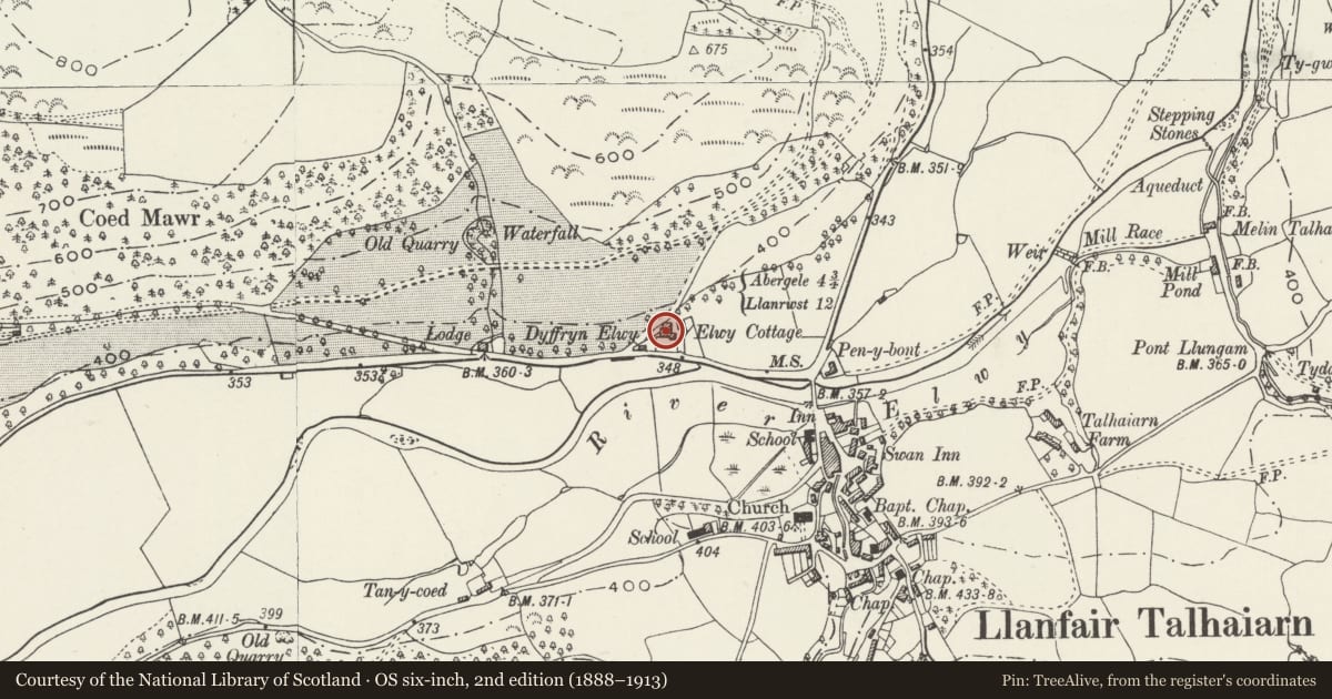
Slide toward Today to fade the historical sheet and see the modern map underneath.
David Rumsey Map Collection, Stanford LibrariesNational Library of ScotlandDavid Rumsey Map Collection, Stanford LibrariesLlyfrgell Genedlaethol Cymru – The National Library of WalesDavid Rumsey Map Collection, Stanford Libraries
5 historical maps cover this location, the earliest the 1795 map "To Sir Watkin Williams-Wynn Bart ... the map of the six counties of North Wales is most humbly inscribed by his obedient humble servant" (Llyfrgell Genedlaethol Cymru – The National Library of Wales).
Historical maps covering this location
- 1795 · To Sir Watkin Williams-Wynn Bart ... the map of the six counties of North Wales is most… (Llyfrgell Genedlaethol Cymru – The National Library of Wales)
- 1830 · V.3:11-15:XV. Britisches Reich. A. Kon: England. b. Frstenthum Wales: Shire: 37-40 (David Rumsey Map Collection, Stanford Libraries)
- 1883 · Watershed map England, Wales 3. (David Rumsey Map Collection, Stanford Libraries)
- 1901 · Sheet 9 and 10. (David Rumsey Map Collection, Stanford Libraries)
- 1963 · Map No. 35 - Local Government Commission for Wales : [Definitive maps showing proposed… (National Library of Scotland)
Cadw's description
Location
Set back from the main road approximately 0.5 km NW of the village centre on the N side of the river Elwy; behind a hedged front garden.
History
Late Regency/early Victorian 2-storey villa of c1835, with C20 addition to the SE.
Exterior
Of rubble construction with original graded, shallow-pitched, hipped slate roof with lead flashings and oversailing eaves; 2 plain chimneys with simple cornicing and Victorian chimney pots. Three-bay facade with raised ground floor and central entrance; this has a single-storey flat-roofed porch, accessed via a flight of steps from the garden, with square supporting corner posts and simple moulded entablature. Original 6-panel door (lower 2 blind) with rectangular multi-pane fanlight. Both ground and first floors retain their original, slightly-recessed 12-pane unhorned sashes with fanned slate-stone lintels and projecting sills. A lower, wide gabled service wing adjoins to the rear with further 12-pane original sashes and a later C19 4-pane sash to the W side; to the E are12-pane sashes to the first floor with later C19 paired 4-pane sashes to the ground floor. A single-storey hipped-roofed modern extension adjoins to the SE.
Interior
The interior was not inspected at the time of survey.
Reason for designation
Listed for its special interest as an imposing second-quarter C19 house with well-preserved external character in a prominent road-side position.
Group value with Elwy Cottage.
Nearby in the register
- Elwy CottageDomesticunder 1 mi
- MilestoneTransportunder 1 mi
- Llanfair BridgeTransportunder 1 mi
- Old SchoolEducationunder 1 mi
Other entries of the same register within about three miles of this one, by straight line.