Cof Cymru: National Historic Assets of Wales · Wales
Tan-y-Graig Farmhouse
Llanfair Talhaiarn, Conwy, Wales
A Grade II listed building in Melai, Llanfair Talhaiarn, Conwy, designated on 22 July 1998.
The record
- Designation
- Listed building, Grade II
- Broad class
- Domestic
- Date of designation
- 22 July 1998
- Locality
- Melai
- Community
- Llanfair Talhaiarn
- Unitary authority
- Conwy
- Country
- Wales
- Coordinates
- 53.20189, -3.64767
- Cadw reference
- 20150
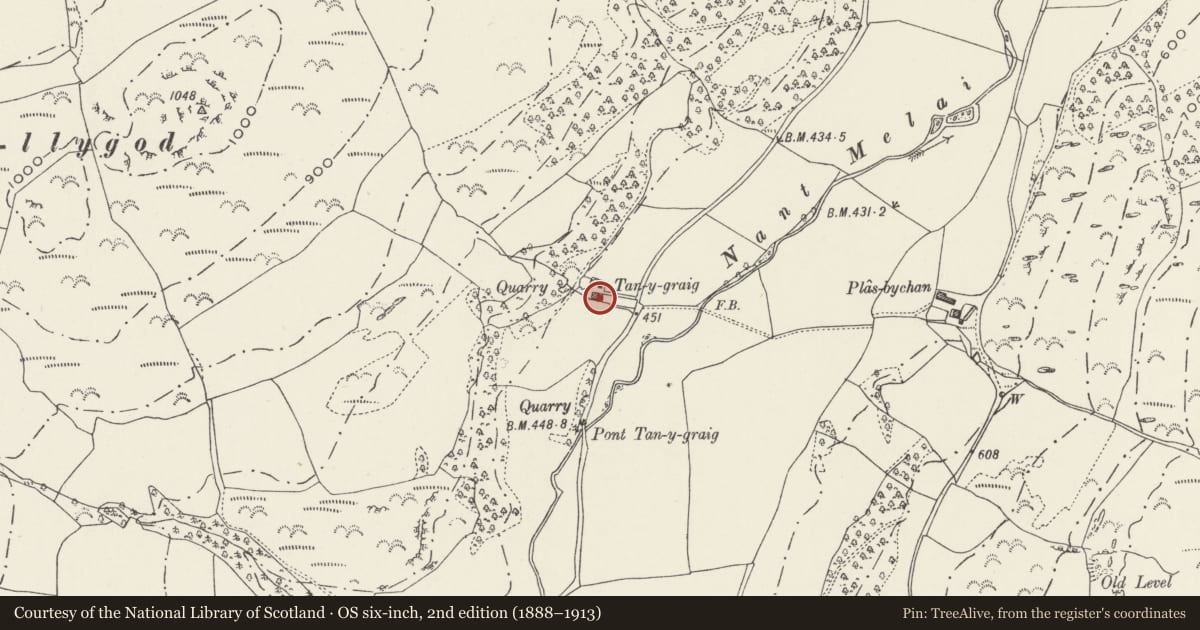
Slide toward Today to fade the historical sheet and see the modern map underneath.
David Rumsey Map Collection, Stanford LibrariesDavid Rumsey Map Collection, Stanford LibrariesLlyfrgell Genedlaethol Cymru – The National Library of WalesDavid Rumsey Map Collection, Stanford LibrariesDavid Rumsey Map Collection, Stanford Libraries
5 historical maps cover this location, the earliest the 1608 map "(13) Cambriae Typus." (David Rumsey Map Collection, Stanford Libraries).
Historical maps covering this location
- 1608 · (13) Cambriae Typus. (David Rumsey Map Collection, Stanford Libraries)
- 1795 · To Sir Watkin Williams-Wynn Bart ... the map of the six counties of North Wales is most… (Llyfrgell Genedlaethol Cymru – The National Library of Wales)
- 1830 · V.3:11-15:XV. Britisches Reich. A. Kon: England. b. Frstenthum Wales: Shire: 37-40 (David Rumsey Map Collection, Stanford Libraries)
- 1883 · Watershed map England, Wales 3. (David Rumsey Map Collection, Stanford Libraries)
- 1901 · Sheet 9 and 10. (David Rumsey Map Collection, Stanford Libraries)
Cadw's description
Location
Located at the SW boundary of the community, approximately 0.6km N of Melai, set back to the NW of the old road from Llanfair Talhaiarn to Llangernyw; accessed via a short track.
History
Storeyed vernacular end-chimney farmhouse, probably of mid or second-half C18 date
Exterior
Of whitened rubble construction with slated roof (small slates) and squat end chimneys; brick gable parapet to front R gable. 3-bay symmetrical front with central entrance; original boarded and studded door in a stopped-chamfered frame with exposed timber lintel. Flanking this are slightly recessed wooden cross-windows with small-pane glazing and cambered heads; rough-dressed voussoirs. Second-half C19 6-pane sashes to first floor; all windows have projecting stone sills. Plain rear with low outshut to L section, probably an original feature; corrugated iron roof.
Interior
The interior was not accessible at the time of survey.
Reason for designation
Listed for its special interest as an C18 vernacular storeyed farmhouse retaining good external character.
Nearby in the register
- MelaiDomesticunder 1 mi
- Former Domestic Range at MelaiDomesticunder 1 mi
- Bridge immediately SW of MelaiTransportunder 1 mi
- Former Stable and Coach-house Range at MelaiDomesticunder 1 mi
Other entries of the same register within about three miles of this one, by straight line.