Cof Cymru: National Historic Assets of Wales · Wales
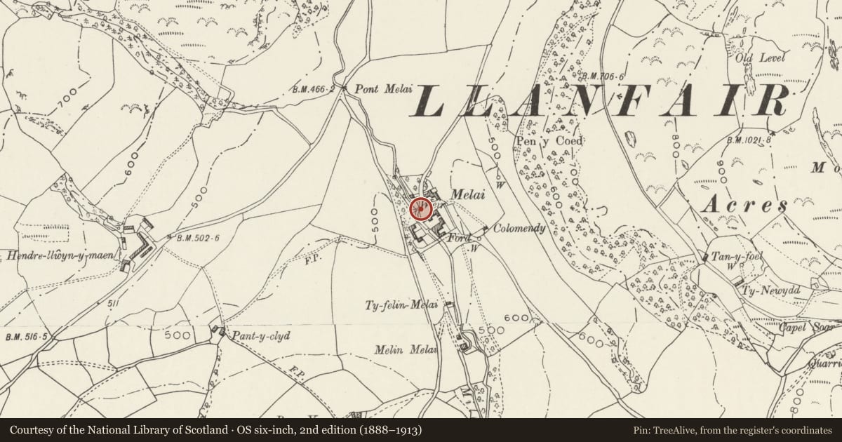
Bridge immediately SW of Melai
Llanfair Talhaiarn, Conwy, Wales
A Grade II listed building in Melai, Llanfair Talhaiarn, Conwy, designated on 30 January 1968.
The record
- Designation
- Listed building, Grade II
- Broad class
- Transport
- Date of designation
- 30 January 1968
- Locality
- Melai
- Community
- Llanfair Talhaiarn
- Unitary authority
- Conwy
- Country
- Wales
- Coordinates
- 53.19547, -3.64653
- Cadw reference
- 195
Slide toward Today to fade the historical sheet and see the modern map underneath.
David Rumsey Map Collection, Stanford LibrariesLlyfrgell Genedlaethol Cymru – The National Library of WalesDavid Rumsey Map Collection, Stanford LibrariesDavid Rumsey Map Collection, Stanford LibrariesDavid Rumsey Map Collection, Stanford Libraries
5 historical maps cover this location, the earliest the 1608 map "(13) Cambriae Typus." (David Rumsey Map Collection, Stanford Libraries).
Historical maps covering this location
- 1608 · (13) Cambriae Typus. (David Rumsey Map Collection, Stanford Libraries)
- 1795 · To Sir Watkin Williams-Wynn Bart ... the map of the six counties of North Wales is most… (Llyfrgell Genedlaethol Cymru – The National Library of Wales)
- 1830 · V.3:11-15:XV. Britisches Reich. A. Kon: England. b. Frstenthum Wales: Shire: 37-40 (David Rumsey Map Collection, Stanford Libraries)
- 1883 · Watershed map England, Wales 3. (David Rumsey Map Collection, Stanford Libraries)
- 1901 · Sheet 9 and 10. (David Rumsey Map Collection, Stanford Libraries)
Cadw's description
Location
Spanning the Nant Melai immediately SW of the house and farm group and giving access to the site.
History
Single-span bridge, probably of C17 origin, and constructed to give access to the house and farm group at Melai. The bridge has been slightly widened on the downstream side, perhaps in the early C19 at which time new agricultural ranges were constructed. Melai was an important seat in the early medieval period and was the ancestral home of the Wynnes of Melai and Maenan Abbey; from this house descended the Wynnes of Garthewin and the Lords Newborough of Rug. Melai produced High Sheriffs for Denbighshire in 1577, 1586, 1614, 1637 and finally 1712; thereafter Melai appears to have been tenanted.
Exterior
Single-span road bridge of local rubble construction; segmental arch with rough-dressed, recessed voussoirs. The carriageway is slightly humped and the bridge has rubble parapets, curved at the approaches and with cock-and-hen coping.
Reason for designation
Listed for the special historic and architectural interest of its origins as a bridge constructed to provide access to the farmstead at Melai.
Group value with other listed items at Melai.
Nearby in the register
- Former Stable and Coach-house Range at MelaiDomesticunder 1 mi
- MelaiDomesticunder 1 mi
- Former Domestic Range at MelaiDomesticunder 1 mi
- C-shaped Agricultural Range at MelaiAgriculture and Subsistenceunder 1 mi
Other entries of the same register within about three miles of this one, by straight line.