Cof Cymru: National Historic Assets of Wales · Wales
Ty Isaf (NW Cottage)
Buan, Gwynedd, Wales
A Grade II listed building in Rhydyclafdy, Pwllheli, Buan, Gwynedd, designated on 15 July 1998.
The record
- Designation
- Listed building, Grade II
- Broad class
- Domestic
- Date of designation
- 15 July 1998
- Locality
- Rhydyclafdy
- Town
- Pwllheli
- Community
- Buan
- Unitary authority
- Gwynedd
- Country
- Wales
- Coordinates
- 52.88289, -4.50565
- Cadw reference
- 20140
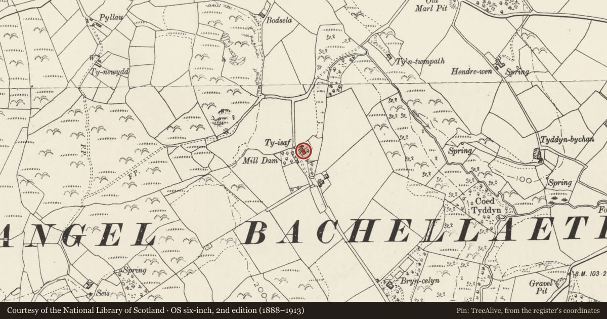
Slide toward Today to fade the historical sheet and see the modern map underneath.
David Rumsey Map Collection, Stanford LibrariesDavid Rumsey Map Collection, Stanford LibrariesDavid Rumsey Map Collection, Stanford LibrariesDavid Rumsey Map Collection, Stanford LibrariesDavid Rumsey Map Collection, Stanford Libraries
5 historical maps cover this location, the earliest the 1830 map "V.3:11-15:XV. Britisches Reich. A. Kon: England. b. Frstenthum Wales: Shire: 37-40" (David Rumsey Map Collection, Stanford Libraries).
Historical maps covering this location
- 1830 · V.3:11-15:XV. Britisches Reich. A. Kon: England. b. Frstenthum Wales: Shire: 37-40 (David Rumsey Map Collection, Stanford Libraries)
- 1883 · Watershed map England, Wales 3. (David Rumsey Map Collection, Stanford Libraries)
- 1896 · Sheet 7. Ordnance Survey of England and Wales. (David Rumsey Map Collection, Stanford Libraries)
- 1899 · 134 Pwllheli (Hills) (David Rumsey Map Collection, Stanford Libraries)
- 1901 · Sheet 9 and 10. (David Rumsey Map Collection, Stanford Libraries)
Cadw's description
Location
Situated 700m S of the B4415 road, and approx 1.4 km WSW of the village of Rhydyclafdy.
History
Earlier C19 vernacular house with later C19 additional cottage, in stone-walled front gardens. Marked on OS drawings of 1816-19.
Exterior
Stone lean-to on left end wall.
Reason for designation
Grade II as good example of a well proportioned early C19 estate house, with the second house sympathetically added in the later C19, to form a good vernacular group.
Nearby in the register
- Ty Isaf (SE Cottage)Domesticunder 1 mi
- Roadsign SE of BogdadleTransportunder 1 mi
- Gallt-y-berenDomesticunder 1 mi
- MilestoneTransportunder 1 mi
Other entries of the same register within about three miles of this one, by straight line.