Cof Cymru: National Historic Assets of Wales · Wales
Lodge to N of Plas Boduan
Buan, Gwynedd, Wales
A Grade II listed building in Boduan, Pwllheli, Buan, Gwynedd, designated on 15 July 1998.
The record
- Designation
- Listed building, Grade II
- Broad class
- Domestic
- Date of designation
- 15 July 1998
- Locality
- Boduan
- Town
- Pwllheli
- Community
- Buan
- Unitary authority
- Gwynedd
- Country
- Wales
- Coordinates
- 52.91893, -4.49434
- Cadw reference
- 20118
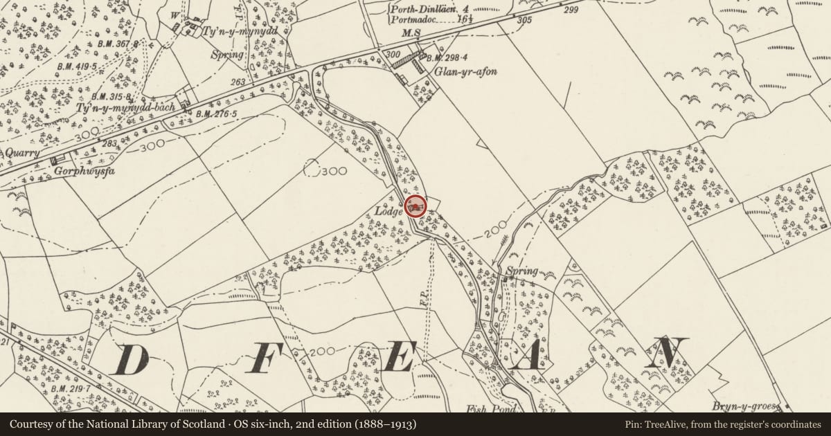
Slide toward Today to fade the historical sheet and see the modern map underneath.
David Rumsey Map Collection, Stanford LibrariesDavid Rumsey Map Collection, Stanford LibrariesDavid Rumsey Map Collection, Stanford LibrariesDavid Rumsey Map Collection, Stanford LibrariesDavid Rumsey Map Collection, Stanford Libraries
5 historical maps cover this location, the earliest the 1830 map "V.3:11-15:XV. Britisches Reich. A. Kon: England. b. Frstenthum Wales: Shire: 37-40" (David Rumsey Map Collection, Stanford Libraries).
Historical maps covering this location
- 1830 · V.3:11-15:XV. Britisches Reich. A. Kon: England. b. Frstenthum Wales: Shire: 37-40 (David Rumsey Map Collection, Stanford Libraries)
- 1883 · Watershed map England, Wales 3. (David Rumsey Map Collection, Stanford Libraries)
- 1896 · Sheet 7. Ordnance Survey of England and Wales. (David Rumsey Map Collection, Stanford Libraries)
- 1899 · 118 Nevin (Hills) (David Rumsey Map Collection, Stanford Libraries)
- 1901 · Sheet 9 and 10. (David Rumsey Map Collection, Stanford Libraries)
Cadw's description
Location
Situated E side of former drive now road running N from Boduan Hall, some 600m NW of the house.
History
Former Plas Boduan lodge, probably mid to later C19, although an earlier lodge is marked on the 2" OS map of 1816-19. Said to have been the gamekeeper's house.
Exterior
L-plan single-storey picturesque cottage. Granite rubble-stone walls, partly whitewashed. Slate roofs with half-hipped gables to N and to W end of S crosswing. Overhanging eaves and central rendered chimney. W front has projecting crosswing to right with one 3-light window and hoodmould to end wall and door in N return. Main range has cat-slide roof over 3-bay rustic veranda with tree-trunk uprights and rough 4-centred arcading. Similar window within and another to N end wall. All windows are mullion-and-transom with latticed glazing and flat hoodmoulds. Rear C20 extension.
Reason for designation
Included as a good example of a picturesque Victorian estate cottage.
Nearby in the register
- GlanrafonDomesticunder 1 mi
- Plas BoduanDomesticunder 1 mi
- Out-buildings at Home Farm, Plas BoduanAgriculture and Subsistenceunder 1 mi
- BryntirionDomesticunder 1 mi
Other entries of the same register within about three miles of this one, by straight line.