Cof Cymru: National Historic Assets of Wales · Wales
Toll Cottage
Cynwyl Elfed, Carmarthenshire, Wales
A Grade II listed building in Cwmduad, Carmarthen, Cynwyl Elfed, Carmarthenshire, designated on 10 July 1998.
The record
- Designation
- Listed building, Grade II
- Broad class
- Transport
- Date of designation
- 10 July 1998
- Locality
- Cwmduad
- Town
- Carmarthen
- Community
- Cynwyl Elfed
- Unitary authority
- Carmarthenshire
- Country
- Wales
- Coordinates
- 51.95442, -4.36412
- Cadw reference
- 20116
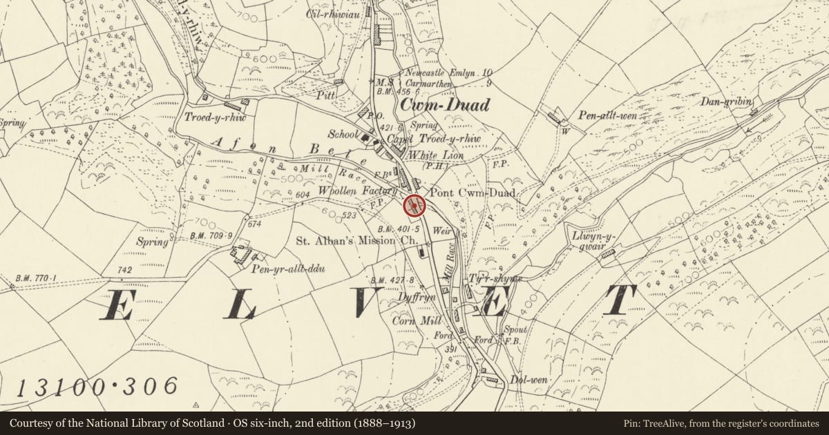
Slide toward Today to fade the historical sheet and see the modern map underneath.
David Rumsey Map Collection, Stanford LibrariesDavid Rumsey Map Collection, Stanford LibrariesDavid Rumsey Map Collection, Stanford LibrariesDavid Rumsey Map Collection, Stanford LibrariesDavid Rumsey Map Collection, Stanford Libraries
5 historical maps cover this location, the earliest the 1636 map "Cornubia : Devonia, Somersetus, Dorcestria, Wiltonia, Glocestria ..." (David Rumsey Map Collection, Stanford Libraries).
Historical maps covering this location
- 1636 · Cornubia : Devonia, Somersetus, Dorcestria, Wiltonia, Glocestria ... (David Rumsey Map Collection, Stanford Libraries)
- 1860 · 41. Caermathen. (David Rumsey Map Collection, Stanford Libraries)
- 1891 · Sheet 10. Ordnance Survey of England and Wales. . (David Rumsey Map Collection, Stanford Libraries)
- 1898 · 211 Newcastle Emlyn (Hills) (David Rumsey Map Collection, Stanford Libraries)
- 1901 · Sheet 14. (David Rumsey Map Collection, Stanford Libraries)
Cadw's description
Location
On W side of A 484, in loop of old road now by-passed.
History
Early C19 toll house. According to local tradition replaced wooden toll house burned by Rebecca Rioters in 1847.
Exterior
Single storey toll house with semi-hexagonal front. Rubble (lime-washed) with slate sills and rectangular hood moulds over windows; hipped slate roof, central rectangular stone chimney with tented slate cover. Central doorway (C20 stable door); to each side in splays, original narrow window openings with late C19/early C20 horned sash windows; similar window to L side (towards rear) has casement glazing.
Interior
Not inspected but, said to be divided into 2 rooms by transverse wall with fireplace, front room has recess said to have been used for toll monies; doorway to rear room which has modern partition forming kitchen/bathroom.
Reason for designation
Well-preserved early C19 toll house.
Nearby in the register
- Nantclawdd IsafDomesticunder 1 mi
- Pantyffynnon IsafDomesticunder 1 mi
- BlaencerdinDomesticunder 1 mi
- WaunyrhafodDomesticunder 1 mi
Other entries of the same register within about three miles of this one, by straight line.