Cof Cymru: National Historic Assets of Wales · Wales
Ty Bach / Ty Nesaf
Aberdaron, Gwynedd, Wales
A Grade II listed building in Yr Enlli / Bardsey Island, Pwllheli, Aberdaron, Gwynedd, designated on 26 June 1998.
The record
- Designation
- Listed building, Grade II
- Broad class
- Domestic
- Date of designation
- 26 June 1998
- Locality
- Yr Enlli / Bardsey Island
- Town
- Pwllheli
- Community
- Aberdaron
- Unitary authority
- Gwynedd
- Country
- Wales
- Coordinates
- 52.76380, -4.78833
- Cadw reference
- 20058
Slide toward Today to fade the historical sheet and see the modern map underneath.
David Rumsey Map Collection, Stanford LibrariesDavid Rumsey Map Collection, Stanford LibrariesDavid Rumsey Map Collection, Stanford LibrariesDavid Rumsey Map Collection, Stanford LibrariesDavid Rumsey Map Collection, Stanford Libraries
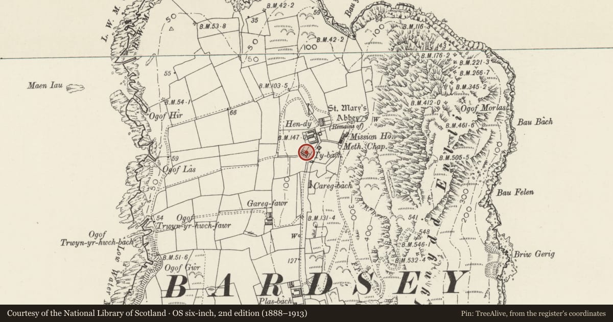
5 historical maps cover this location, the earliest the 1608 map "(13) Cambriae Typus." (David Rumsey Map Collection, Stanford Libraries).
Historical maps covering this location
- 1608 · (13) Cambriae Typus. (David Rumsey Map Collection, Stanford Libraries)
- 1637 · Particular description of Wales. Cambria seu Wallia (David Rumsey Map Collection, Stanford Libraries)
- 1799 · Ireland. (David Rumsey Map Collection, Stanford Libraries)
- 1883 · Watershed map England, Wales 3. (David Rumsey Map Collection, Stanford Libraries)
- 1898 · 133 Bardsey Island (Hills) (David Rumsey Map Collection, Stanford Libraries)
Cadw's description
Location
Situated about 100m SW of Abbey ruin, on W side of track.
History
Semi-detached pair of farm-houses, part of the general rebuilding of the farms on the island by the 3rd Baron Newborough, c1870-5. Similar to the other 3 such pairs: Hendy/Ty Nant, Cristin, and Ty Pella/Rhedynog Goch.
Exterior
Pair of farmhouses, whitewashed stucco fronts and rubble stone, with slate gabled roofs and 3 red brick ridge stacks. One and a half storeys, H-plan with crosswings framing centre. Windows are of small-paned timber mullion and transom type, some replaced. Crosswings have small 3-light windows above larger 3-light windows, and there are lean-to porches in angles to centre which has 2 similar 2-light windows. Rear is rubble stone with similar arrangement of windows and porches, the windows with brick sides and slab lintels. Ledged doors.
Reason for designation
Included as good example of distinctively designed later C19 model-farm building and part of the fine group at the N end of the island.
Nearby in the register
- Walls to Ty Bach / Ty NesafDomesticunder 1 mi
- Double Farm-court to Hendy/Ty Nant and Ty Bach/Ty Nesaf.Domesticunder 1 mi
- Memorial Cross in graveyard to SReligious, Ritual and Funeraryunder 1 mi
- Ruin of Abbey of St MaryReligious, Ritual and Funeraryunder 1 mi
Other entries of the same register within about three miles of this one, by straight line.