Cof Cymru: National Historic Assets of Wales · Wales
Syntir
Aberdaron, Gwynedd, Wales
A Grade II listed building in Rhiw, Pwllheli, Aberdaron, Gwynedd, designated on 26 June 1998.
The record
- Designation
- Listed building, Grade II
- Broad class
- Domestic
- Date of designation
- 26 June 1998
- Locality
- Rhiw
- Town
- Pwllheli
- Community
- Aberdaron
- Unitary authority
- Gwynedd
- Country
- Wales
- Coordinates
- 52.81690, -4.62464
- Cadw reference
- 20026
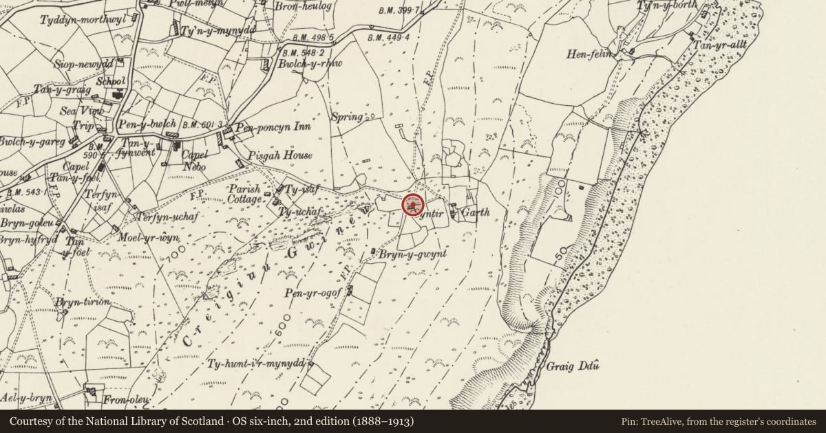
Slide toward Today to fade the historical sheet and see the modern map underneath.
David Rumsey Map Collection, Stanford LibrariesDavid Rumsey Map Collection, Stanford LibrariesDavid Rumsey Map Collection, Stanford LibrariesDavid Rumsey Map Collection, Stanford LibrariesDavid Rumsey Map Collection, Stanford Libraries
5 historical maps cover this location, the earliest the 1608 map "(13) Cambriae Typus." (David Rumsey Map Collection, Stanford Libraries).
Historical maps covering this location
- 1608 · (13) Cambriae Typus. (David Rumsey Map Collection, Stanford Libraries)
- 1830 · V.3:11-15:XV. Britisches Reich. A. Kon: England. b. Frstenthum Wales: Shire: 37-40 (David Rumsey Map Collection, Stanford Libraries)
- 1883 · Watershed map England, Wales 3. (David Rumsey Map Collection, Stanford Libraries)
- 1899 · 134 Pwllheli (Hills) (David Rumsey Map Collection, Stanford Libraries)
- 1901 · Sheet 9 and 10. (David Rumsey Map Collection, Stanford Libraries)
Cadw's description
Location
Situated on steep slope above Porth Neigwl, some 500m down footpath from Penygroes in Rhiw village.
History
Croglofft cottage, possibly C18, built on the steep slope between Mynydd y Graig and the sea, first built as an independent holding on common land, later owned by the Plas yn Rhiw estate, owners by 1842 when it was occupied by John Griffith, with 1 acre (0.4ha).
Exterior
Cottage with attached former byre; whitewashed rubble stone with grouted slate roof, coped gables and stone tall stack at W end with dripstones and pyramidal cement capping. One storey and loft, double-fronted with 4-pane horned sash each side of door on S front. Slab lintels. Cottage is built downhill to slope with earlier C20 sunroom added at E end. Small original loft light in gable end over. At W end, to slightly lower roof line is former byre, partly rebuilt in C20 with one door to right.
Reason for designation
Included as a good example of a single-storey cottage forming part of an encroachment on the commons at the limits of cultivable land. The building retains its vernacular character, and in particular the original layout of the cottage and attached byre, notwithstanding alterations to the latter.
Nearby in the register
- Pen-yr-ogofDomesticunder 1 mi
- Capel NeboReligious, Ritual and Funeraryunder 1 mi
- Ty Capel NeboDomesticunder 1 mi
- PwllmelynDomesticunder 1 mi
Other entries of the same register within about three miles of this one, by straight line.