Cof Cymru: National Historic Assets of Wales · Wales
Pwllmelyn
Aberdaron, Gwynedd, Wales
A Grade II listed building in Rhiw, Pwllheli, Aberdaron, Gwynedd, designated on 6 April 1998.
The record
- Designation
- Listed building, Grade II
- Broad class
- Domestic
- Date of designation
- 6 April 1998
- Locality
- Rhiw
- Town
- Pwllheli
- Community
- Aberdaron
- Unitary authority
- Gwynedd
- Country
- Wales
- Coordinates
- 52.82076, -4.63260
- Cadw reference
- 20032
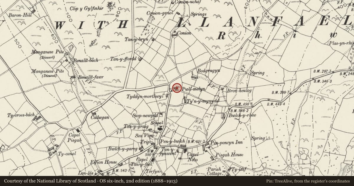
Slide toward Today to fade the historical sheet and see the modern map underneath.
David Rumsey Map Collection, Stanford LibrariesDavid Rumsey Map Collection, Stanford LibrariesDavid Rumsey Map Collection, Stanford LibrariesDavid Rumsey Map Collection, Stanford LibrariesDavid Rumsey Map Collection, Stanford Libraries
5 historical maps cover this location, the earliest the 1608 map "(13) Cambriae Typus." (David Rumsey Map Collection, Stanford Libraries).
Historical maps covering this location
- 1608 · (13) Cambriae Typus. (David Rumsey Map Collection, Stanford Libraries)
- 1830 · V.3:11-15:XV. Britisches Reich. A. Kon: England. b. Frstenthum Wales: Shire: 37-40 (David Rumsey Map Collection, Stanford Libraries)
- 1883 · Watershed map England, Wales 3. (David Rumsey Map Collection, Stanford Libraries)
- 1899 · 134 Pwllheli (Hills) (David Rumsey Map Collection, Stanford Libraries)
- 1901 · Sheet 9 and 10. (David Rumsey Map Collection, Stanford Libraries)
Cadw's description
Location
Situated at upper end of Rhiw village, on E side of T-junction with upper road from Rhiw church.
History
Single storey croglofft cottage with attached small outbuilding; possibly C18 though perhaps rebuilt in earlier C19. One of the early sites in Rhiw, first mentioned in 1766, on Plas-yn-Rhiw land. The site indicates a pattern of settlement around the outer edges of the Plas-yn-Rhiw estate. Marked on 1842 Tithe Map as occupied by Samuel Jones, with 2 acres (0.8ha).
Exterior
Cottage, pebbledashed with grouted slate roof and stone stacks, the smaller to right end, the larger to left on ridge between house and byre which is of whitewashed rubble stone. Single-storey, double-fronted with 4-pane sash each side of ledged door. Byre to left has stable-door at extreme right, and pigsty attached to rear left corner, whitewashed with grouted slates and one door.
At right end of house are attached added outbuildings with corrugated iron roofs.
Reason for designation
Included as a single storey cottage little altered, with byre and pigsty in line, forming a good example of a small cottage holding, a type characteristic of the region.
Nearby in the register
- Capel NeboReligious, Ritual and Funeraryunder 1 mi
- Ty Capel NeboDomesticunder 1 mi
- Bwlch-y-garregDomesticunder 1 mi
- Goose-shelter at Bwlch-y-garregDomesticunder 1 mi
Other entries of the same register within about three miles of this one, by straight line.