Cof Cymru: National Historic Assets of Wales · Wales
Penyborth
Aberdaron, Gwynedd, Wales
A Grade II listed building in Bodferin, Pwllheli, Aberdaron, Gwynedd, designated on 26 June 1998.
The record
- Designation
- Listed building, Grade II
- Broad class
- Domestic
- Date of designation
- 26 June 1998
- Locality
- Bodferin
- Town
- Pwllheli
- Community
- Aberdaron
- Unitary authority
- Gwynedd
- Country
- Wales
- Coordinates
- 52.85355, -4.71745
- Cadw reference
- 20005
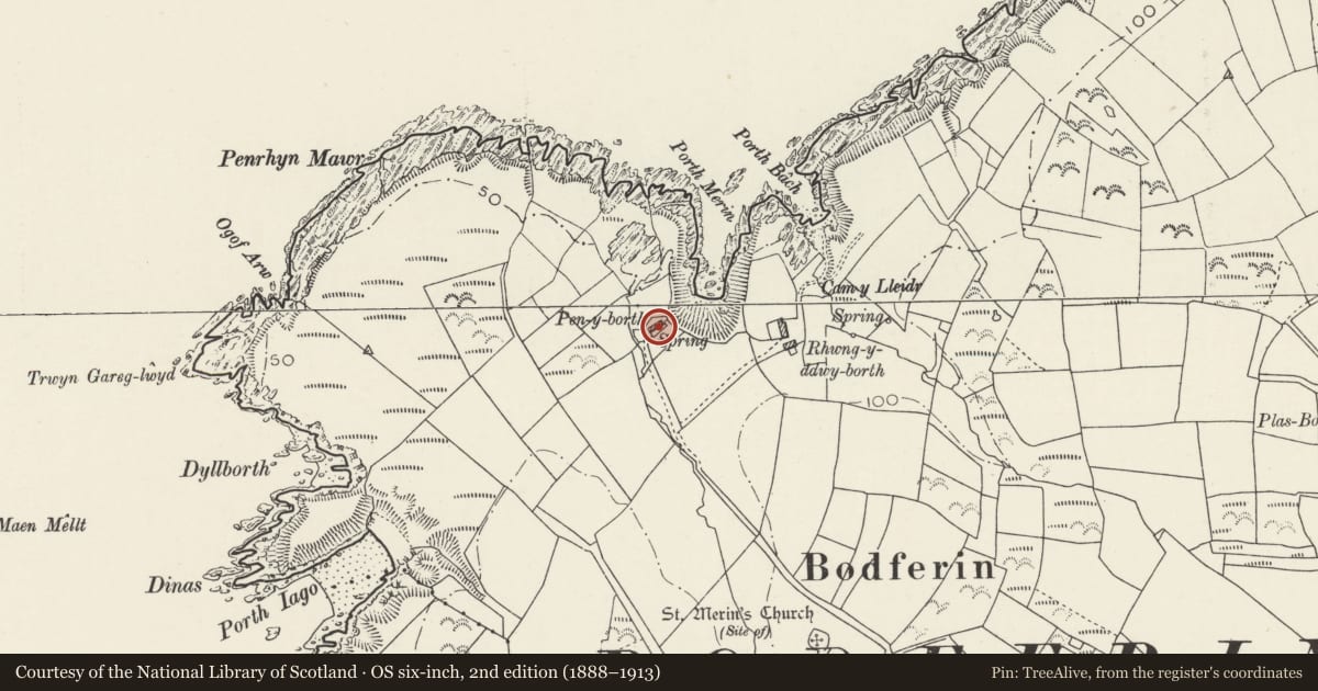
Slide toward Today to fade the historical sheet and see the modern map underneath.
David Rumsey Map Collection, Stanford LibrariesDavid Rumsey Map Collection, Stanford LibrariesDavid Rumsey Map Collection, Stanford LibrariesDavid Rumsey Map Collection, Stanford LibrariesDavid Rumsey Map Collection, Stanford Libraries
5 historical maps cover this location, the earliest the 1608 map "(13) Cambriae Typus." (David Rumsey Map Collection, Stanford Libraries).
Historical maps covering this location
- 1608 · (13) Cambriae Typus. (David Rumsey Map Collection, Stanford Libraries)
- 1830 · V.3:11-15:XV. Britisches Reich. A. Kon: England. b. Frstenthum Wales: Shire: 37-40 (David Rumsey Map Collection, Stanford Libraries)
- 1883 · Watershed map England, Wales 3. (David Rumsey Map Collection, Stanford Libraries)
- 1898 · 133 Bardsey Island (Hills) (David Rumsey Map Collection, Stanford Libraries)
- 1901 · Sheet 9 and 10. (David Rumsey Map Collection, Stanford Libraries)
Cadw's description
Location
Situated just above Porth Ferin cove approached by lane and track of about 1 km from Ty-Hen on Carreg to Llangwnadl road.
History
Small croglofft cottage and attached outbuilding probably early C19, unusual in having only one window to front. Marked on 1840 Bodferin Tithe Map as Penrallt owned by the Carreg estate occupied by Richard Williams. Penyporth was then the name of fields nearby owned by Sir Robert W Vaughan Bt, also occupied by Richard Williams. Later owned by the Penrhyn estate.
Exterior
Cottage with outbuilding in line. Cottage is whitewashed rubble stone with grouted slate roof and roughcast end stacks with driptsones. Left stack is on ridge between house and outbuilding to left. Single storey, with just one small window to right and ledged door to centre. Slab lintels. Rendered right end wall and rendered rear with 2 small windows. Rubble stone, slate-roofed outbuilding, possible byre, to left with 2 full-height doors.
Reason for designation
Included as a good example of a small croglofft cottage and byre range, of a type characteristic of the region.
Nearby in the register
- Site of St Merin's ChurchChurchunder 1 mi
- CilyradwyDomestic1 mi
- Barn to N of MethlemAgriculture and Subsistence1 mi
- Ty MawrDomestic2 mi
Other entries of the same register within about three miles of this one, by straight line.