Cof Cymru: National Historic Assets of Wales · Wales
Outbuilding to N of Nant Bran Farmhouse
Wenvoe, Vale of Glamorgan, Wales
A Grade II listed building in Dyffryn, Wenvoe, Vale of Glamorgan, designated on 28 May 1998.
The record
- Designation
- Listed building, Grade II
- Broad class
- Agriculture and Subsistence
- Date of designation
- 28 May 1998
- Locality
- Dyffryn
- Community
- Wenvoe
- Unitary authority
- Vale of Glamorgan
- Country
- Wales
- Coordinates
- 51.44869, -3.29407
- Cadw reference
- 19892
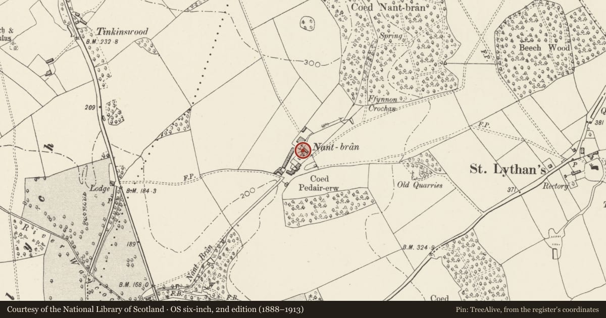
Slide toward Today to fade the historical sheet and see the modern map underneath.
David Rumsey Map Collection, Stanford LibrariesDavid Rumsey Map Collection, Stanford LibrariesDavid Rumsey Map Collection, Stanford LibrariesDavid Rumsey Map Collection, Stanford LibrariesDavid Rumsey Map Collection, Stanford Libraries
5 historical maps cover this location, the earliest the 1636 map "Cornubia : Devonia, Somersetus, Dorcestria, Wiltonia, Glocestria ..." (David Rumsey Map Collection, Stanford Libraries).
Historical maps covering this location
- 1636 · Cornubia : Devonia, Somersetus, Dorcestria, Wiltonia, Glocestria ... (David Rumsey Map Collection, Stanford Libraries)
- 1637 · The fourth table of England. Cornub. Devonia, Somerset etc. (David Rumsey Map Collection, Stanford Libraries)
- 1865 · England and Wales. England No. 6. (David Rumsey Map Collection, Stanford Libraries)
- 1898 · 263 Cardiff (Hills) (David Rumsey Map Collection, Stanford Libraries)
- 1913 · Sheet 110. Cardiff & Mouth of the Severn. (David Rumsey Map Collection, Stanford Libraries)
Cadw's description
Location
Near N corner of Nant Bran Farmhouse, aligned SW-NE.
History
Early-to-mid C19. OS map of 1878 shows a further range at right angles to this one.
Exterior
Lofted agricultural building in local roughly coursed rubble, partly rendered; shallow-pitched slate roof. Elevation facing SE (ie garden) has pair of doors to centre and the roofline of a former lean-to at end right. SW downhill gable has square window to each floor, and brick chimney to each corner, the right chimney is corbelled out over rounded corner of buiding. No openings to NW elevation facing farmyard; stone stairs to door at upper level at NE uphill gable.
Interior
SW ground floor room has boiler and oven.
Reason for designation
Listed as part of a good group of farm buildings. Group value with other buildings at Nant Bran Farm.
Nearby in the register
- Nant Bran FarmhouseDomesticunder 1 mi
- Agricultural Range opposite Nant Bran Farmhouse.Agriculture and Subsistenceunder 1 mi
- Former Bull Shed at Nant Bran Farm.Agriculture and Subsistenceunder 1 mi
- St Lythans Chambered TombChambered long barrowunder 1 mi
Other entries of the same register within about three miles of this one, by straight line.