Cof Cymru: National Historic Assets of Wales · Wales
St Lythans Chambered Tomb
Wenvoe, Vale of Glamorgan, Wales
A scheduled monument in Wenvoe, Vale of Glamorgan, recorded as Chambered long barrow (Prehistoric).
The record
- Designation
- Scheduled monument
- Site type
- Chambered long barrow
- Period
- Prehistoric
- Welsh name
- Beddrod Siambr Llwyneliddon
- Community
- Wenvoe
- Unitary authority
- Vale of Glamorgan
- Country
- Wales
- Coordinates (centre of the scheduled area)
- 51.44257, -3.29513
- SAM number
- GM008
- Cadw record number
- 3363
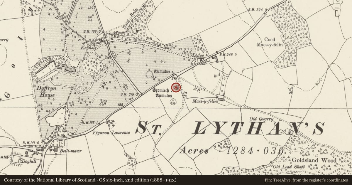
Slide toward Today to fade the historical sheet and see the modern map underneath.
David Rumsey Map Collection, Stanford LibrariesDavid Rumsey Map Collection, Stanford LibrariesDavid Rumsey Map Collection, Stanford LibrariesDavid Rumsey Map Collection, Stanford LibrariesDavid Rumsey Map Collection, Stanford Libraries
5 historical maps cover this location, the earliest the 1636 map "Cornubia : Devonia, Somersetus, Dorcestria, Wiltonia, Glocestria ..." (David Rumsey Map Collection, Stanford Libraries).
Historical maps covering this location
- 1636 · Cornubia : Devonia, Somersetus, Dorcestria, Wiltonia, Glocestria ... (David Rumsey Map Collection, Stanford Libraries)
- 1637 · The fourth table of England. Cornub. Devonia, Somerset etc. (David Rumsey Map Collection, Stanford Libraries)
- 1865 · England and Wales. England No. 6. (David Rumsey Map Collection, Stanford Libraries)
- 1898 · 263 Cardiff (Hills) (David Rumsey Map Collection, Stanford Libraries)
- 1913 · Sheet 110. Cardiff & Mouth of the Severn. (David Rumsey Map Collection, Stanford Libraries)
Cadw's description
Summary description and reason for designation
The following provides a general description of the Scheduled Ancient Monument.
The monument comprises the remains of a burial chamber dating to the Neolithic (c. 4400-2900 BC). A low roughly rectangular mound stretches out approximately 30m to the west of the chamber. The burial chamber has an entrance on the east side and is constructed from three large mudstone uprights and a capstone. It is unusually high and may never have been completely covered by the surrounding mound.
The monument is of national importance for its potential to enhance our knowledge of prehistoric burial and ritual. The monument is an important relic of a prehistoric funerary and ritual landscape and retains significant archaeological potential, with a strong probability of the presence of both intact burial or ritual deposits and environmental and structural evidence, including a buried prehistoric land surface.
The scheduled area comprises the remains described and areas around them which related evidence may be expected to survive.
Nearby in the register
- Lion stepsGardens, Parks and Urban Spacesunder 1 mi
- Lower South Terrace at Dyffryn Gardens(partly in St Nicholas and Bonvilston Community)Gardens, Parks and Urban Spacesunder 1 mi
- Dyffryn HouseDomesticunder 1 mi
- Fountain to South of Dyffryn House(partly in St Nicholas and Bonvilston Community)Gardens, Parks and Urban Spacesunder 1 mi
Other entries of the same register within about three miles of this one, by straight line.