Cof Cymru: National Historic Assets of Wales · Wales
Tal-y-Bryn
Llannefydd, Conwy, Wales
A Grade II listed building in Plas Buckley, Llannefydd, Conwy, designated on 15 May 1998.
The record
- Designation
- Listed building, Grade II
- Broad class
- Domestic
- Date of designation
- 15 May 1998
- Locality
- Plas Buckley
- Community
- Llannefydd
- Unitary authority
- Conwy
- Country
- Wales
- Coordinates
- 53.22374, -3.50228
- Cadw reference
- 19860
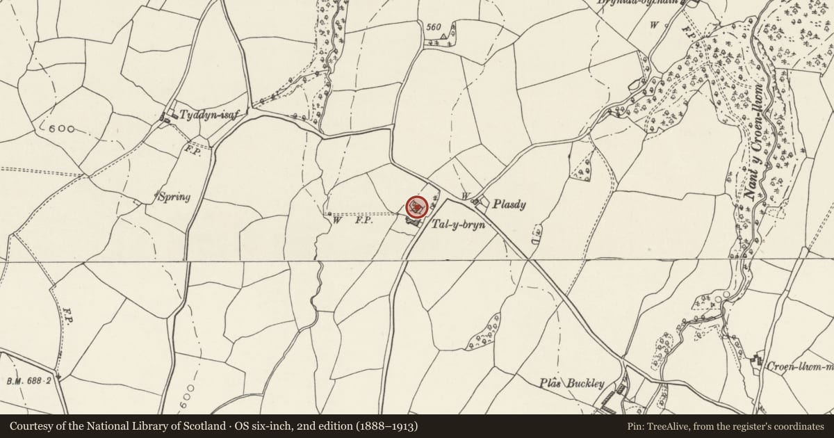
Slide toward Today to fade the historical sheet and see the modern map underneath.
David Rumsey Map Collection, Stanford LibrariesNational Library of ScotlandDavid Rumsey Map Collection, Stanford LibrariesLlyfrgell Genedlaethol Cymru – The National Library of WalesDavid Rumsey Map Collection, Stanford Libraries
5 historical maps cover this location, the earliest the 1795 map "To Sir Watkin Williams-Wynn Bart ... the map of the six counties of North Wales is most humbly inscribed by his obedient humble servant" (Llyfrgell Genedlaethol Cymru – The National Library of Wales).
Historical maps covering this location
- 1795 · To Sir Watkin Williams-Wynn Bart ... the map of the six counties of North Wales is most… (Llyfrgell Genedlaethol Cymru – The National Library of Wales)
- 1830 · V.3:11-15:XV. Britisches Reich. A. Kon: England. b. Frstenthum Wales: Shire: 37-40 (David Rumsey Map Collection, Stanford Libraries)
- 1883 · Watershed map England, Wales 3. (David Rumsey Map Collection, Stanford Libraries)
- 1901 · Sheet 9 and 10. (David Rumsey Map Collection, Stanford Libraries)
- 1963 · Map No. 35 - Local Government Commission for Wales : [Definitive maps showing proposed… (National Library of Scotland)
Cadw's description
Location
Located approximately 1.5km E of Llannefydd village on a prominent site on the cross roads between the unclassified lanes leading to Llannefydd, Henllan and Bont Newydd; set back slightly behind a garden.
Exterior
Storeyed house of central chimney and lobby-entry plan, probably of early C17 date; of whitened rubble construction with slate roof; massive central stack (unwhitened), with early C19 rendered extension to L. Near-central entrance with C19 cambered head and boarded door. Flanking this are modern copies of C19 8-pane windows, again with cambered heads; to the far L is a further, smaller 8-pane window. The first floor has similar, though uncambered windows under the eaves; a small 8-pane to the far L, a 4-pane window to the centre and flanking 8-pane windows. The R gable end has original window openings to both floors, with timber lintels and cills, that to the ground-floor originally a 4-light wooden mullioned window. C19 outshut to the rear and a modern single-storey garage and porch addition to the L gable.
Interior
Former hall (to L of entrance) with Tudor-arched entrance from lobby and wide fireplace with fire-damaged bressummer; stopped-chamfered beamed ceilings to that and former parlour (to R).
Reason for designation
Listed for its special historic interest as a C17 storeyed lobby-entry house retaining good external character.
Nearby in the register
- Primary Barn and adjoining Cart Bays to NE of Plas BuckleyAgriculture and Subsistenceunder 1 mi
- Bod-Ysgawen-IsafDomesticunder 1 mi
- Agricultural Range at Bryn DeunyddAgriculture and Subsistenceunder 1 mi
- Bryn Deunydd Old ChapelReligious, Ritual and Funeraryunder 1 mi
Other entries of the same register within about three miles of this one, by straight line.