Cof Cymru: National Historic Assets of Wales · Wales
Bryn Deunydd Old Chapel
Llannefydd, Conwy, Wales
A Grade II listed building in Bryn Deunydd, Llannefydd, Conwy, designated on 15 May 1998.
The record
- Designation
- Listed building, Grade II
- Broad class
- Religious, Ritual and Funerary
- Date of designation
- 15 May 1998
- Locality
- Bryn Deunydd
- Community
- Llannefydd
- Unitary authority
- Conwy
- Country
- Wales
- Coordinates
- 53.21326, -3.50981
- Cadw reference
- 19865
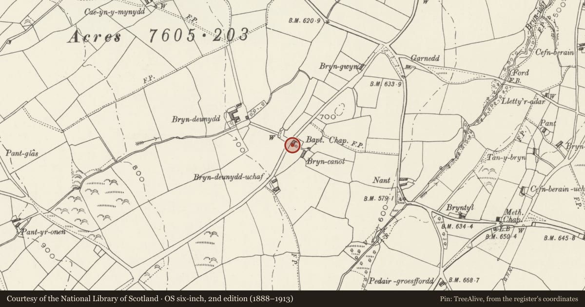
Slide toward Today to fade the historical sheet and see the modern map underneath.
David Rumsey Map Collection, Stanford LibrariesNational Library of ScotlandDavid Rumsey Map Collection, Stanford LibrariesLlyfrgell Genedlaethol Cymru – The National Library of WalesDavid Rumsey Map Collection, Stanford Libraries
5 historical maps cover this location, the earliest the 1795 map "To Sir Watkin Williams-Wynn Bart ... the map of the six counties of North Wales is most humbly inscribed by his obedient humble servant" (Llyfrgell Genedlaethol Cymru – The National Library of Wales).
Historical maps covering this location
- 1795 · To Sir Watkin Williams-Wynn Bart ... the map of the six counties of North Wales is most… (Llyfrgell Genedlaethol Cymru – The National Library of Wales)
- 1830 · V.3:11-15:XV. Britisches Reich. A. Kon: England. b. Frstenthum Wales: Shire: 37-40 (David Rumsey Map Collection, Stanford Libraries)
- 1883 · Watershed map England, Wales 3. (David Rumsey Map Collection, Stanford Libraries)
- 1901 · Sheet 9 and 10. (David Rumsey Map Collection, Stanford Libraries)
- 1963 · Map No. 35 - Local Government Commission for Wales : [Definitive maps showing proposed… (National Library of Scotland)
Cadw's description
Location
Located approximately 1.5km SE of Llannefydd and 300m NW of Cefn Berain; on the SE side of the lane.
History
Scotch Baptist chapel built in 1823 by John Jones of Pandy at a cost of £87.10s.9d (£87.54p). Originally it had a beaten earth floor and backless benches. It was ceiled over in 1852 and finally replaced by the current (adjacent) chapel in 1877.
Exterior
Small rectangular chapel of roughcast rubble with slated roof and tiled ridge; kneelered and slab-coped gable parapets, with squat end chimney to the rear gable. The NE side has a boarded and studded door to the R, in a later C19 stopped-chamfered doorframe; to the L is a recessed, unhorned original sash window of 16 panes. The SW side has 2 further, similar windows, that to the R obscured by a C20 timber and corrugated iron lean-to opening onto a stone-walled yard.
Interior
Plain 2-bay interior with king-post truss.
Reason for designation
Listed for its special socio-historic interest as a first-quarter C19 chapel of small and diminishing branch of the Baptist denomination, retaining good external character.
Nearby in the register
- Bryn DeunyddDomesticunder 1 mi
- Agricultural Range at Bryn DeunyddAgriculture and Subsistenceunder 1 mi
- Agricultural Range at Plas CochAgriculture and Subsistenceunder 1 mi
- Primary House at Plas CochDomesticunder 1 mi
Other entries of the same register within about three miles of this one, by straight line.