Cof Cymru: National Historic Assets of Wales · Wales
Lane Farm Farmhouse
Willington Worthenbury, Wrexham, Wales
A Grade II listed building in Willington, Wrexham, Willington Worthenbury, designated on 7 May 1998.
The record
- Designation
- Listed building, Grade II
- Broad class
- Domestic
- Date of designation
- 7 May 1998
- Locality
- Willington
- Town
- Wrexham
- Community
- Willington Worthenbury
- Unitary authority
- Wrexham
- Country
- Wales
- Coordinates
- 52.98585, -2.80425
- Cadw reference
- 19782
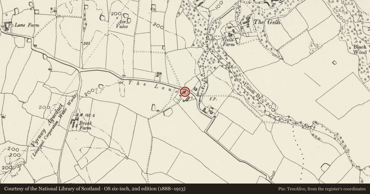
Slide toward Today to fade the historical sheet and see the modern map underneath.
David Rumsey Map Collection, Stanford LibrariesDavid Rumsey Map Collection, Stanford LibrariesDavid Rumsey Map Collection, Stanford LibrariesDavid Rumsey Map Collection, Stanford LibrariesDavid Rumsey Map Collection, Stanford Libraries
5 historical maps cover this location, the earliest the 1637 map "Particular description of Wales. Cambria seu Wallia" (David Rumsey Map Collection, Stanford Libraries).
Historical maps covering this location
- 1637 · Particular description of Wales. Cambria seu Wallia (David Rumsey Map Collection, Stanford Libraries)
- 1861 · 73. Market Drayton. (David Rumsey Map Collection, Stanford Libraries)
- 1883 · Watershed map England, Wales 3. (David Rumsey Map Collection, Stanford Libraries)
- 1897 · 122 Nantwich (Hills) (David Rumsey Map Collection, Stanford Libraries)
- 1901 · Sheet 9 and 10. (David Rumsey Map Collection, Stanford Libraries)
Cadw's description
Location
Located on the south side of, and at right angles to, The Lane, from Tallarn Green towards Tybroughton House.
History
Probably early C19 and maybe associated with one of the local estates.
Exterior
Two-storey, brown brick farmhouse with slate roof and later rear extensions including cat-slide roof. Three brick chimney stacks, one to either gable end and one to rear projection. Wooden porch placed centrally in front elevation. Brick dentilated eaves. Four iron casement windows of three lights to front elevation in a Gothic pattern in the manner of those made at John ("Iron Mad") Wilkinson's Bersham works with small-panes and diamond-paned heads. Sash window above door.
Interior
Interior not accessible at time of survey.
Reason for designation
Listed as a good example of an early C18 farmhouse retaining original iron casement windows.
Nearby in the register
- Barn and shippon at Gelli FarmNo class recordedunder 1 mi
- Stable at Gelli FarmNo class recordedunder 1 mi
- Gelli FarmhouseDomesticunder 1 mi
- Garden walls and bothy at The GelliNo class recordedunder 1 mi
Other entries of the same register within about three miles of this one, by straight line.