Cof Cymru: National Historic Assets of Wales · Wales
Admiralty House
Willington Worthenbury, Wrexham, Wales
A Grade II listed building in Worthenbury, Wrexham, Willington Worthenbury, designated on 7 May 1998.
The record
- Designation
- Listed building, Grade II
- Broad class
- Domestic
- Date of designation
- 7 May 1998
- Locality
- Worthenbury
- Town
- Wrexham
- Community
- Willington Worthenbury
- Unitary authority
- Wrexham
- Country
- Wales
- Coordinates
- 53.00958, -2.86616
- Cadw reference
- 19769
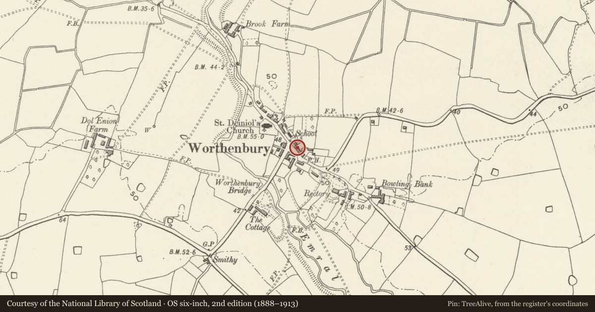
Slide toward Today to fade the historical sheet and see the modern map underneath.
David Rumsey Map Collection, Stanford LibrariesDavid Rumsey Map Collection, Stanford LibrariesDavid Rumsey Map Collection, Stanford LibrariesDavid Rumsey Map Collection, Stanford LibrariesDavid Rumsey Map Collection, Stanford Libraries
5 historical maps cover this location, the earliest the 1637 map "Particular description of Wales. Cambria seu Wallia" (David Rumsey Map Collection, Stanford Libraries).
Historical maps covering this location
- 1637 · Particular description of Wales. Cambria seu Wallia (David Rumsey Map Collection, Stanford Libraries)
- 1861 · 73. Market Drayton. (David Rumsey Map Collection, Stanford Libraries)
- 1883 · Watershed map England, Wales 3. (David Rumsey Map Collection, Stanford Libraries)
- 1897 · 122 Nantwich (Hills) (David Rumsey Map Collection, Stanford Libraries)
- 1901 · Sheet 9 and 10. (David Rumsey Map Collection, Stanford Libraries)
Cadw's description
Location
Located on the north side of the main road through Worthenbury (B 5069) shortly after its junction with Church Road and adjacent to The Malt House. Set back behind iron-railed narrow forecourt.
History
Early to mid C19 late Georgian house (shown on Tithe Map).
Exterior
Two-storey brick house under slate roof; brickwork laid to form distinctive diaper pattern formed by light and dark brick. Set back behind iron-railed narrow forecourt. Centrally planned facade around central doorcase with wooden reveals and Gothick lozenges to the frieze and rectangular fanlight. Six-panelled door with fielded upper panels. Five recessed twelve-paned wooden sash windows with glazing bars. Brick chimney stack to west gable end. Rendered plinth and lintels.
Reason for designation
Listed together with The Malt House and adjacent cottages as a prominent historic group in the centre of the village.
Nearby in the register
- The Malt House including attached cottage to rightDomesticunder 1 mi
- Shop CottageDomesticunder 1 mi
- Parish Church of St DeiniolReligious, Ritual and Funeraryunder 1 mi
- Worthenbury BridgeTransportunder 1 mi
Other entries of the same register within about three miles of this one, by straight line.