Cof Cymru: National Historic Assets of Wales · Wales
The Malt House including attached cottage to right
Willington Worthenbury, Wrexham, Wales
A Grade II listed building in Worthenbury, Wrexham, Willington Worthenbury, designated on 16 November 1962.
The record
- Designation
- Listed building, Grade II
- Broad class
- Domestic
- Date of designation
- 16 November 1962
- Locality
- Worthenbury
- Town
- Wrexham
- Community
- Willington Worthenbury
- Unitary authority
- Wrexham
- Country
- Wales
- Coordinates
- 53.00951, -2.86608
- Cadw reference
- 1707
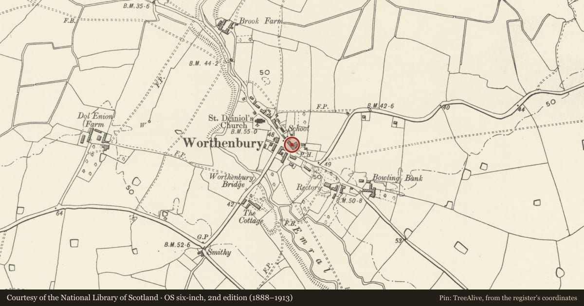
Slide toward Today to fade the historical sheet and see the modern map underneath.
David Rumsey Map Collection, Stanford LibrariesDavid Rumsey Map Collection, Stanford LibrariesDavid Rumsey Map Collection, Stanford LibrariesDavid Rumsey Map Collection, Stanford LibrariesDavid Rumsey Map Collection, Stanford Libraries
5 historical maps cover this location, the earliest the 1637 map "Particular description of Wales. Cambria seu Wallia" (David Rumsey Map Collection, Stanford Libraries).
Historical maps covering this location
- 1637 · Particular description of Wales. Cambria seu Wallia (David Rumsey Map Collection, Stanford Libraries)
- 1861 · 73. Market Drayton. (David Rumsey Map Collection, Stanford Libraries)
- 1883 · Watershed map England, Wales 3. (David Rumsey Map Collection, Stanford Libraries)
- 1897 · 122 Nantwich (Hills) (David Rumsey Map Collection, Stanford Libraries)
- 1901 · Sheet 9 and 10. (David Rumsey Map Collection, Stanford Libraries)
Cadw's description
Location
Prominently located to the north side of the main road through Worthenbury (B 5069) to the east of, and stepped forward from the adjoining Admiralty House.
History
Late C18/early C19 house. Now incorporating single-storey cottage to east which was formerly the Post Office.
Exterior
Three storey, 2-window, brown brick front with dentilated eaves under slate roof; ground floor is whitewashed. Brick chimney stack to eastern gable end. Centrally composed facade around nailed front door under gabled hood. Six, 3-light, near-flush, casement windows with cambered heads; small-pane to 2nd floor. Changes to brickwork show original house to have been raised in C19.
Stepped down to right is a two-storey painted brown-brick cottage forming part of a terrace with Shop Cottage. Slate roof, centrally placed doorway under gabled hood. Toothed dentilated brick eaves. 2-light casement window to first floor, two modern bow windows to ground.
Interior
At time of refurbishment in 1980's former Post Office incorporated into ownership of the former Malt House to form one single dwelling by alterations to plan form.
Reason for designation
Listed for the special interest of its late C18/early C19 origins and for group value with neighbouring listed items, of historic character in the centre of the village.
Nearby in the register
- Admiralty HouseDomesticunder 1 mi
- Shop CottageDomesticunder 1 mi
- Parish Church of St DeiniolReligious, Ritual and Funeraryunder 1 mi
- Worthenbury BridgeTransportunder 1 mi
Other entries of the same register within about three miles of this one, by straight line.