Cof Cymru: National Historic Assets of Wales · Wales
Bodlondeb
Llanengan, Gwynedd, Wales
A Grade II listed building in Nanhoron, Pwllheli, Llanengan, Gwynedd, designated on 1 April 1998.
The record
- Designation
- Listed building, Grade II
- Broad class
- Domestic
- Date of designation
- 1 April 1998
- Locality
- Nanhoron
- Town
- Pwllheli
- Community
- Llanengan
- Unitary authority
- Gwynedd
- Country
- Wales
- Coordinates
- 52.85286, -4.54371
- Cadw reference
- 19642
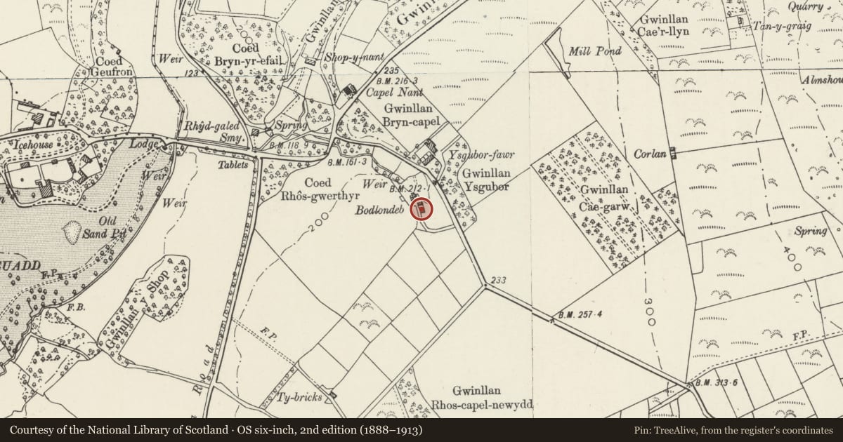
Slide toward Today to fade the historical sheet and see the modern map underneath.
David Rumsey Map Collection, Stanford LibrariesDavid Rumsey Map Collection, Stanford LibrariesDavid Rumsey Map Collection, Stanford LibrariesDavid Rumsey Map Collection, Stanford LibrariesDavid Rumsey Map Collection, Stanford Libraries
5 historical maps cover this location, the earliest the 1608 map "(13) Cambriae Typus." (David Rumsey Map Collection, Stanford Libraries).
Historical maps covering this location
- 1608 · (13) Cambriae Typus. (David Rumsey Map Collection, Stanford Libraries)
- 1830 · V.3:11-15:XV. Britisches Reich. A. Kon: England. b. Frstenthum Wales: Shire: 37-40 (David Rumsey Map Collection, Stanford Libraries)
- 1883 · Watershed map England, Wales 3. (David Rumsey Map Collection, Stanford Libraries)
- 1899 · 134 Pwllheli (Hills) (David Rumsey Map Collection, Stanford Libraries)
- 1901 · Sheet 9 and 10. (David Rumsey Map Collection, Stanford Libraries)
Cadw's description
Location
Situated on W side of B4413 some 600m E of Nanhoron bridge.
History
Small Nanhoron estate farmhouse, probably of c1870, connected with the large and earlier estate farmyard across the road at Ysgubor Fawr.
Exterior
Farmhouse, squared granite rubble stone with slate roofs, plain bargeboards and timber gable finials. Roughcast ridge stack. One and a half storeys, L-plan with crosswing at N end projecting E. Sash and casement windows with unusual reduced number of glazing bars in upper parts. Crosswing E gable has 2/12-pane sash over lean-to stone window projection with slate roof and triple casement with top-lights. Main range to left has stone gabled porch in angle with similar casement pair to E and door to S side. Similar casement pair to ground floor left. S end gable has first floor similar sash over similar casement pair under slate pent roof on large stone corbels. Rear has roof hipped at NW angle and dormer gable with C20 plastic window.
Reason for designation
A well-preserved small later C19 estate farmhouse of a type rare in the region.
Nearby in the register
- MilestoneTransportunder 1 mi
- Capel NantReligious, Ritual and Funeraryunder 1 mi
- RhydgaledDomesticunder 1 mi
- Siop-y-NantDomesticunder 1 mi
Other entries of the same register within about three miles of this one, by straight line.