Cof Cymru: National Historic Assets of Wales · Wales
Rhydgaled
Llanengan, Gwynedd, Wales
A Grade II listed building in Nanhoron, Pwllheli, Llanengan, Gwynedd, designated on 1 April 1998.
The record
- Designation
- Listed building, Grade II
- Broad class
- Domestic
- Date of designation
- 1 April 1998
- Locality
- Nanhoron
- Town
- Pwllheli
- Community
- Llanengan
- Unitary authority
- Gwynedd
- Country
- Wales
- Coordinates
- 52.85430, -4.54877
- Cadw reference
- 19617
Slide toward Today to fade the historical sheet and see the modern map underneath.
David Rumsey Map Collection, Stanford LibrariesDavid Rumsey Map Collection, Stanford LibrariesDavid Rumsey Map Collection, Stanford LibrariesDavid Rumsey Map Collection, Stanford LibrariesDavid Rumsey Map Collection, Stanford Libraries
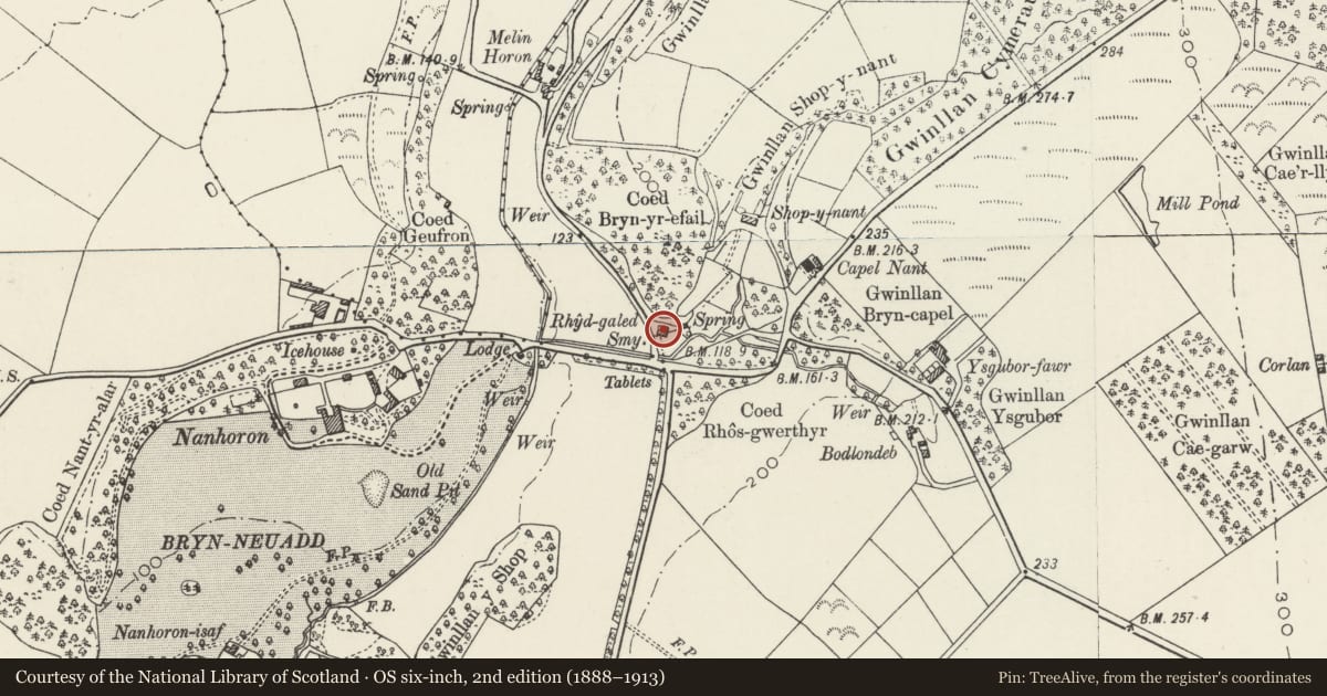
5 historical maps cover this location, the earliest the 1608 map "(13) Cambriae Typus." (David Rumsey Map Collection, Stanford Libraries).
Historical maps covering this location
- 1608 · (13) Cambriae Typus. (David Rumsey Map Collection, Stanford Libraries)
- 1830 · V.3:11-15:XV. Britisches Reich. A. Kon: England. b. Frstenthum Wales: Shire: 37-40 (David Rumsey Map Collection, Stanford Libraries)
- 1883 · Watershed map England, Wales 3. (David Rumsey Map Collection, Stanford Libraries)
- 1899 · 134 Pwllheli (Hills) (David Rumsey Map Collection, Stanford Libraries)
- 1901 · Sheet 9 and 10. (David Rumsey Map Collection, Stanford Libraries)
Cadw's description
Location
Situated on E side of B4415 just N of junction with B4413 at Nanhoron.
History
Early C19 Nanhoron estate house with attached forge. A stone reset on corner has 1788 or 1728 date inscribed. Marked on 1839 Tithe Map as Rhydgaled Smithy House occupied by Thomas Roberts.
Exterior
House, rubble stone in long dark green rough-faced blocks with slate roof and stone end stacks, larger to left. Two-storey, double-fronted and offset to right, with 2x16-pane hornless sashes each floor and half-glazed door between. Slate sills, slab lintels. Large W side lean-to with 6-pane upper window and 16-pane lower window in S end. Broad opening on W side. Rear wing with red brick N end stack. Attached to NW corner of W lean-to is former smithy with N end stone stack, S end door with slab lintel and wall carried across with flat parapet from S gable to house NW corner. One metal window on W side.
Interior
Smithy has massive N end fireplace with curved timber bressumer and one collar-truss to roof.
Reason for designation
Included as good well-preserved example of traditional house in late Georgian style with surviving smithy.
Nearby in the register
- MilestoneTransportunder 1 mi
- Siop-y-NantDomesticunder 1 mi
- Entrance Gates at NanhoronDomesticunder 1 mi
- The Lodge at NanhoronDomesticunder 1 mi
Other entries of the same register within about three miles of this one, by straight line.