Cof Cymru: National Historic Assets of Wales · Wales
Mill at Felin Newydd
Llanengan, Gwynedd, Wales
A Grade II listed building in Nanhoron, Pwllheli, Llanengan, Gwynedd, designated on 1 April 1998.
The record
- Designation
- Listed building, Grade II
- Broad class
- Agriculture and Subsistence
- Date of designation
- 1 April 1998
- Locality
- Nanhoron
- Town
- Pwllheli
- Community
- Llanengan
- Unitary authority
- Gwynedd
- Country
- Wales
- Coordinates
- 52.85729, -4.55088
- Cadw reference
- 19629
Slide toward Today to fade the historical sheet and see the modern map underneath.
David Rumsey Map Collection, Stanford LibrariesDavid Rumsey Map Collection, Stanford LibrariesDavid Rumsey Map Collection, Stanford LibrariesDavid Rumsey Map Collection, Stanford LibrariesDavid Rumsey Map Collection, Stanford Libraries
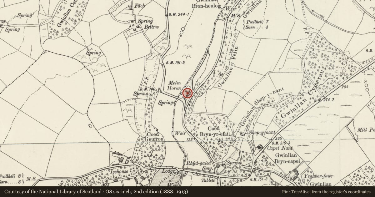
5 historical maps cover this location, the earliest the 1608 map "(13) Cambriae Typus." (David Rumsey Map Collection, Stanford Libraries).
Historical maps covering this location
- 1608 · (13) Cambriae Typus. (David Rumsey Map Collection, Stanford Libraries)
- 1830 · V.3:11-15:XV. Britisches Reich. A. Kon: England. b. Frstenthum Wales: Shire: 37-40 (David Rumsey Map Collection, Stanford Libraries)
- 1883 · Watershed map England, Wales 3. (David Rumsey Map Collection, Stanford Libraries)
- 1899 · 134 Pwllheli (Hills) (David Rumsey Map Collection, Stanford Libraries)
- 1901 · Sheet 9 and 10. (David Rumsey Map Collection, Stanford Libraries)
Cadw's description
Location
Situated E of mill-house by Afon Horon, just W of B4415, some 100m N of junction with B4413.
History
Corn mill built for the Nanhoron estate, probably mid to later C19 but with date plaque of 1823. Marked as Melin Horon on 1900 O.S.
Exterior
Corn mill, squared grey granite rubble with slate close-eaved roof. Tall 3-storey, one-window range with one-window range in splayed SW angle. Two-storey corn-drying kiln attached to S. Mill has cambered-headed openings with stone voussoirs and slate sills. Entry in SW angle with broad door. Plaque above 'R.E.A. 1823 Na ladratta', i.e. 'Richard and Arabella Edwards, Do not steal'. Large window each floor above and 3 similar windows, one each floor to centre of W range, remnants of small-paned glazing. Mill wheel was in wheel-pit on N end. Rear has first and second floor window.
Drying kiln addition has W front two square loft windows, door to ground floor left and blocked opening ground floor right. Rear has window and door at first floor, ground level due to slope.
Interior
Heavy pine floor beams and centre wooden stair. Machinery removed, but three grind-stones in place on first floor. Two bay roof with wishbone truss. Drying range has small store to ground floor left and loft with pierced tile floor and wishbone roof trusses.
Reason for designation
An estate corn mill of unusual scale, well-detailed, and forming a group with the house to W.
Nearby in the register
- Felin NewyddDomesticunder 1 mi
- Siop-y-NantDomesticunder 1 mi
- Entrance Gates at NanhoronDomesticunder 1 mi
- RhydgaledDomesticunder 1 mi
Other entries of the same register within about three miles of this one, by straight line.