Cof Cymru: National Historic Assets of Wales · Wales
Castell Cottage
Llanengan, Gwynedd, Wales
A Grade II listed building in Cilan, Pwllheli, Llanengan, Gwynedd, designated on 1 April 1998.
The record
- Designation
- Listed building, Grade II
- Broad class
- Domestic
- Date of designation
- 1 April 1998
- Locality
- Cilan
- Town
- Pwllheli
- Community
- Llanengan
- Unitary authority
- Gwynedd
- Country
- Wales
- Coordinates
- 52.79395, -4.53068
- Cadw reference
- 19621
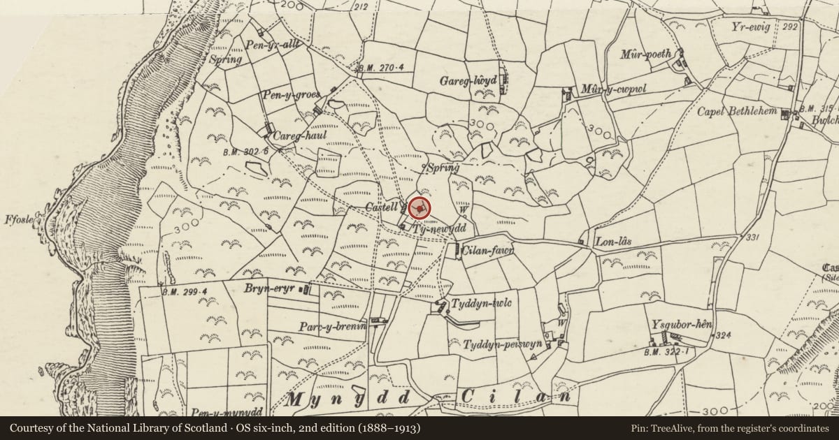
Slide toward Today to fade the historical sheet and see the modern map underneath.
David Rumsey Map Collection, Stanford LibrariesDavid Rumsey Map Collection, Stanford LibrariesDavid Rumsey Map Collection, Stanford LibrariesDavid Rumsey Map Collection, Stanford LibrariesDavid Rumsey Map Collection, Stanford Libraries
5 historical maps cover this location, the earliest the 1608 map "(13) Cambriae Typus." (David Rumsey Map Collection, Stanford Libraries).
Historical maps covering this location
- 1608 · (13) Cambriae Typus. (David Rumsey Map Collection, Stanford Libraries)
- 1830 · V.3:11-15:XV. Britisches Reich. A. Kon: England. b. Frstenthum Wales: Shire: 37-40 (David Rumsey Map Collection, Stanford Libraries)
- 1883 · Watershed map England, Wales 3. (David Rumsey Map Collection, Stanford Libraries)
- 1899 · 134 Pwllheli (Hills) (David Rumsey Map Collection, Stanford Libraries)
- 1901 · Sheet 9 and 10. (David Rumsey Map Collection, Stanford Libraries)
Cadw's description
Location
Situated on Cilan Common, the uppermost of group of four cottages just on the common at end of lane running W from Erw Deg.
History
Single storey cottage, probably earlier C19, part of the encroachment onto common land typical of the area. The rubble stone low wall closely enclosing the front is typical.
Exterior
Cottage, whitewashed rubble stone with slate roof and stone end stacks, larger to left. Roof of large slates, close eaves. Single storey, double fronted with two 4-pane sashes and centre door in C20 rendered flat-topped porch. Half-glazed door. Small loft light on right end wall, lean-to below.
Reason for designation
A little altered single storey cottage, of a type once common in the region, now becoming rare. In its setting, the cottage clearly illustrates the commons encroachment which was a significant pattern of settlement in the area.
Nearby in the register
- GarreglwydDomesticunder 1 mi
- Pared Mawr CampPromontory Fort - coastalunder 1 mi
- Cilan-Uchaf Burial ChamberChambered Tombunder 1 mi
- Chimney of former Llanengan Lead-mineIndustrial1 mi
Other entries of the same register within about three miles of this one, by straight line.