Cof Cymru: National Historic Assets of Wales · Wales
Chimney of former Llanengan Lead-mine
Llanengan, Gwynedd, Wales
A Grade II listed building in Llanengan, Pwllheli, Gwynedd, designated on 1 April 1998.
The record
- Designation
- Listed building, Grade II
- Broad class
- Industrial
- Date of designation
- 1 April 1998
- Locality
- Llanengan
- Town
- Pwllheli
- Community
- Llanengan
- Unitary authority
- Gwynedd
- Country
- Wales
- Coordinates
- 52.81106, -4.53134
- Cadw reference
- 19611
Slide toward Today to fade the historical sheet and see the modern map underneath.
David Rumsey Map Collection, Stanford LibrariesDavid Rumsey Map Collection, Stanford LibrariesDavid Rumsey Map Collection, Stanford LibrariesDavid Rumsey Map Collection, Stanford LibrariesDavid Rumsey Map Collection, Stanford Libraries
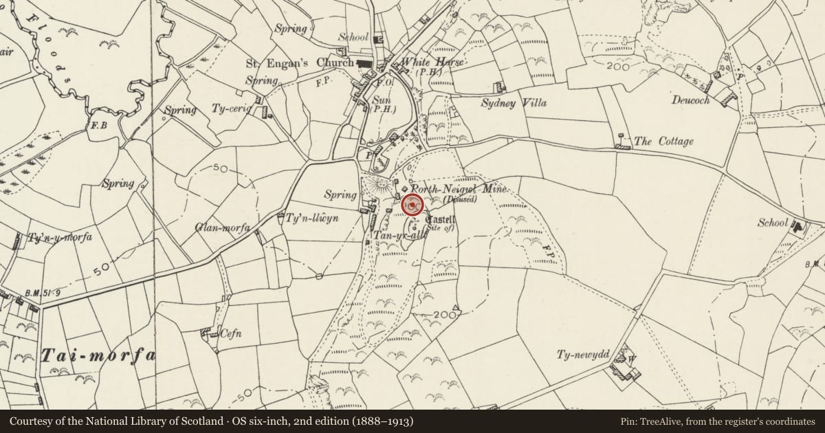
5 historical maps cover this location, the earliest the 1608 map "(13) Cambriae Typus." (David Rumsey Map Collection, Stanford Libraries).
Historical maps covering this location
- 1608 · (13) Cambriae Typus. (David Rumsey Map Collection, Stanford Libraries)
- 1830 · V.3:11-15:XV. Britisches Reich. A. Kon: England. b. Frstenthum Wales: Shire: 37-40 (David Rumsey Map Collection, Stanford Libraries)
- 1883 · Watershed map England, Wales 3. (David Rumsey Map Collection, Stanford Libraries)
- 1899 · 134 Pwllheli (Hills) (David Rumsey Map Collection, Stanford Libraries)
- 1901 · Sheet 9 and 10. (David Rumsey Map Collection, Stanford Libraries)
Cadw's description
Location
Situated high on side of hill E of the village.
History
Large chimney to the Llanengan lead-mine, also known as the Porth Neigwl mine, built c1878. It is uncertain whether its purpose was ventilation of the mine or as a flue for a beam-engine or smelter sited at Tanrallt below. The mine at Llanengan was part of the group of lead-mines in the area, including those at Penrhyndu, Bwlchtocyn, Tanybwlch and Pantgwyn whose history goes back to the C17 and possibly much earlier. The mine at Llanengan was reopened in the 1870s with mine buildings at Tanrallt and closed with the others in 1892. Marked as Porth Neigwl mine (disused) on 1900 revision of 1885 O.S.
Exterior
Tall circular chimney, rubble stone to above mid-height and then red brick banded in yellow brick with yellow brick projecting cornice. Fire opening on S side of base.
Reason for designation
A fine mine chimney which is a prominent landmark and one of the few upstanding remains of the lead-mine.
Nearby in the register
- The RockDomesticunder 1 mi
- GorphwysfaDomesticunder 1 mi
- Telephone Call-box (tel no: 01758 712919)Communicationsunder 1 mi
- Lychgate to S of Church of St EnganReligious, Ritual and Funeraryunder 1 mi
Other entries of the same register within about three miles of this one, by straight line.